Tropical Cyclone Alfred is heading for Australia. Here's what you need to know
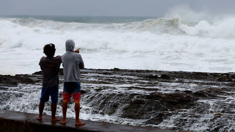
People watch the large waves at Snapper Rocks in the Gold Coast ahead of Tropical Cyclone Alfred. Picture: Chris Hyde/Getty Images
For almost two weeks, Tropical Cyclone Alfred has ambled about the Coral Sea, off the northeast coast of Australia.
Early on Sunday morning the cyclone passed below the Tropic of Capricorn, way off-track for the typical path a cyclone might take to the north Queensland coast.
Forecasters predict Alfred will continue to linger, moving slowly south until Tuesday, then take an erratic sharp turn back towards the heavily populated south-east Queensland coast.
As of Tuesday, coastal communities across the south-east and down into north-eastern New South Wales were preparing for gale-force winds of up to 120km/h.
Authorities also warned of intense rainfall that could lead to dangerous and life-threatening flash flooding and abnormally high tides.
Forecasters from the Bureau of Meteorology predicted on Tuesday that Tropical Cyclone Alfred would turn towards the south-east Queensland coast later that day and make landfall as a category two late on Thursday or early Friday morning.
Communities from Sandy Cape south to Grafton, including Brisbane, Gold Coast, Sunshine Coast and Byron Bay, were in the watch zone.
This remains a forecast, which can change over the coming days. People should keep updated regularly about changes to potentially impacted areas.
As well as winds and storm surges, affected areas were preparing for intense rainfall that the bureau warned could lead to life-threatening flash flooding.
Alfred could dump up to a metre of rain over the elevated ranges and hinterland in parts of south-east Queensland and north-east NSW, according to Weatherzone’s Anthony Sharwood.
“That is an absolutely huge amount — for example, Brisbane’s entire annual rainfall is just over a metre,” Mr Sharwood wrote.
As of Tuesday morning, the bureau was forecasting a maximum rainfall total of up 480mm between Wednesday and Sunday in Brisbane and a maximum total of 545mm for the Gold Coast during the same period.
Tropical cyclones are typically a tropical phenomenon and the fact that Alfred could reach the coastline hundreds of kilometres south of the tropics could be quite dangerous.
There is a huge population in the potential path of the cyclone of more than four million people, most of them living in and around Brisbane. And the Queensland capital is not particularly well-equipped to cope with a cyclone.
Residents of north Queensland and the Northern Territory are well-versed at preparing for cyclones; most have a ready-made cyclone kit with emergency supplies, and many buildings and homes are constructed to withstand strong winds.
Brisbane is also used to storms, but doesn’t cope particularly well with them. The city has severely flooded three times (in 2011, 2017 and 2022) in the past 15 years. Predictions of 300mm to 600mm of rainfall in some areas, after a particularly wet summer, are worrying authorities.
It is unusual to be taking the threat of a cyclone this seriously this far from it making landfall. But authorities are taking this very, very seriously.
As Tropical #CycloneAlfred approaches the #Qld coast, it's important to understand the potential impacts of a tropical cyclone so you can be prepared.
— Bureau of Meteorology, Australia (@BOM_au) March 3, 2025
For the latest tropical cyclone warnings and the Tropical cyclone 7 day forecast, visit https://t.co/4KFWWiahr3 pic.twitter.com/z3Bdr3TGYI
It is rare — but not unheard of — for tropical cyclones to reach landfall south of the tropics.
The closest a cyclone track has come to Brisbane was in 1990, when Tropical Cyclone Nancy tracked erratically towards the Queensland capital, before making a southward turn just off the coastline and never reaching landfall.
Tropical Cyclone Wanda — the cause of historic floods in Brisbane in 1974 — crossed the coast near K’gari and Hervey Bay. A severe tropical cyclone crossed the coast near Tweed Heads in 1954.
It is far more common for a tropical cyclone to cross the coast north of the Tropic of Capricorn and return overland to the south-east as a destructive low storm. This occurred with Cyclone Debbie in 2017.
The Queensland government has a guide for residents to get ready for a potential cyclone, which includes packing a kit with enough basic items for your family to use for three days at home without power.
Residents should make sure loose items are secured or put away.
- The Guardian
Check out the Irish Examiner's WEATHER CENTRE for regularly updated short and long range forecasts wherever you are.


