Temperatures could hit 30C as hot spell continues
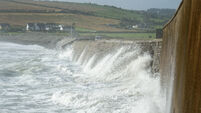
Sunshine and temperatures of 25°C in Bantry brought people out to cool down in the sea. Attempting to cool off were Savo & Kasper Keane from Bantry. Picture: Andy Gibson.
The record temperature for May could be broken again on Tuesday as Met Éireann suggested temperatures could reach 30C.
On Monday, the mercury reached 28.6C at Shannon Airport, breaking the 1997 record, which previously stood at 28.4C.
The highest temperature ever recorded in Ireland saw the mercury hit 33.3C in Kilkenny Castle in 1887.
The national forecaster has said that Tuesday will be another "warm or hot day" with dry weather and sunshine. The north and northwest will see clouds during the afternoon with a chance of an isolated shower.
However, highs of between 23C and 29, or 30C are expected, with the hottest weather in Munster and south Leinster.
Mild and cooler weather will dominate Tuesday night, with temperatures dropping to the low teens and staying between 11C and 17C.
Wednesday will continue with the "warm or hot spell" of weather, and it will be mainly dry and sunny. There is a chance of a few scattered showers breaking out, but highs of between 22C and 29C/30C are set for the day, with the hottest weather for the Midwest and west.
Cloud will increase in the south and bring some drizzle, mist and fog on Wednesday night, especially in the south. Met Éireann have said there is a likelihood of some scattered thundery showers for a time as well, with temperatures sitting between 11C and 16C.
Read More
Thursday will see some sunny spells for a time in parts of the east and north before it becomes cloudy with some light rain, drizzle and mist. However, it will stay mainly dry in the east before it starts to brighten up a little from the west. Temperatures will sit between 17C and 24, with the warmest weather in the east.
It will be a relatively dry day on Friday, with some sunny spells and highs of 17C to 22C, warmest in the east. It will be a little cooler in coastal parts of the west and northwest.
Saturday will start off mainly dry with some sunny spells in the east; however, rain will start to move into the west early on before spreading eastwards through the morning and afternoon, with some turning heavy later. Sunny spells and showers will start to follow in from the west later, with some possibly heavy, and a chance of a thundery downpour in the north. Highs of 16C to 21C are set for the day.
Looking into Sunday, lingering scattered showers will start to become isolated, before dry weather and sunny spells take over. Highs of 15C to 19C are set for the day.
The Bank Holiday Monday or the first day of meteorological summer will be cloudy for a time with outbreaks of rain, turning heavy at times. The rain will clear eastwards with sunshine and highs of 15C to 20C for the day.
Meanwhile, more than 350 French towns have recorded their highest-ever temperatures for May as France and the UK set national heat records amid an extreme early-summer heat event that could see the mercury rise to 40C in parts of Spain by the end of the week.
The UK’s Met Office said the country’s record for May was broken when a temperature of 34.8C was recorded at London’s Kew Gardens.
Météo France said late on Monday that new monthly highs for May had been recorded at 352 weather stations mainly in western France, with the highest – 37.1C – registered near Hossegor, in the south-western department of Landes.
“This is an unprecedented event with a one in 1,000 chance of happening at this time of year based on the climate from 1979 to 2025 and virtually impossible in the preindustrial era,” Christophe Cassou, a climate scientist, told Le Monde.
The hot spell in Spain – where temperatures in some southern areas hit 38C over the weekend, between 5C and 10C higher than normal – is also expected to continue through the week, said Rubén del Campo of the state meteorological office Aemet.
Check out the Irish Examiner's WEATHER CENTRE for regularly updated short and long range forecasts wherever you are.