Maps shed light on Cromwellian conquest
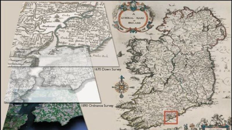
A digital record of the land transfer after the Cromwellian conquest of Ireland has gone live, detailing the 17th-century landlords in every county and parish.

Maps shed light on Cromwellian conquest

The Down Survey has been put online by researchers at Trinity College Dublin detailing the removal of Catholic landowners and the creation of country estates for Protestant merchants and soldiers.

It was the first time in the history of the world that a country had been so extensively mapped.

Already a subscriber? Sign in

You have reached your article limit.

Unlimited access. Half the price.

Annual €130 €65

Best value

Monthly €12€6 / month

More in this section

Lunchtime News

Newsletter

Keep up with stories of the day with our lunchtime news wrap and important breaking news alerts.

Cookie Policy Privacy Policy Brand Safety FAQ Help Contact Us Terms and Conditions

© Examiner Echo Group Limited