What did Cork Harbour look like 15,000 years ago? New study digs deep to reveal all
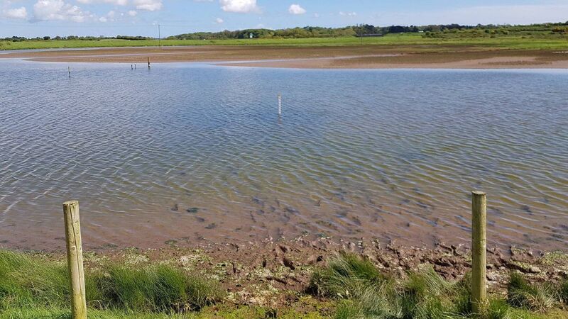
Soil samples analysed by a UCC expert at a marsh area, which has recently been turned into one of the foremost bird-watching sanctuaries in the country, has shed light on what Glounthaune and Harper's Island looked like thousands of years ago.
Lush forestry, arctic tundra, and a sea that began beyond Roche's Point — thanks to a scientific study, a detailed image of what the Cork Harbour area looked like pre- and post-Ice Age has now emerged.
Soil samples analysed by a UCC expert at a marsh area, which has recently been turned into one of the foremost bird-watching sanctuaries in the country, has shed light on what Glounthaune and Harper's Island looked like thousands of years ago.
The study involved extracting soil samples from different depths at the Harper’s Island bird sanctuary. While Bird Watch Ireland, Cork County Council and local volunteers were creating a new wetland habitat for visiting wildlife, those involved in the project had the opportunity to explore the ground beneath.
Jim Wilson, one of the main leaders of the Harper’s Island wildlife regeneration project, said that in 1810 — five years before the Battle of Waterloo — a sea wall was built there to hold back tidal flooding impacts. This eventually became farmland.
“While we were creating what are called scrapes (shallow ponds) we were in the unusual position of being able to dig down through the layers of sediment of this part of Cork Harbour, which had built up over millennia, having lain undisturbed since the last Ice Age,” Mr Wilson said.
They were fortunate enough to have the help of UCC emeritus Professor of Geography Robert Devoy. With his expertise they managed to collect a continuous sample of the sediment and organic material from the time the sea wall was built in 1810 all the way back to the last Ice Age, approximately 15,000 years ago “when you would have had to walk out beyond Roche’s Point to find the sea.”
Professor Devoy said these samples add greatly to our understanding of the history of Cork Harbour and how it has evolved since the last Ice Age.
They were able to radiocarbon date some of the materials found and these include a band of seashells at about 1.4m below today’s sea level, beneath the mudflat surface; radiocarbon dated to about 2,750 years ago. Another band of shells lower down, at about 2.1m below sea level, was radiocarbon dated to approximately 3,380 years ago.
“Amazingly, by chance we found a fragment of a hazelnut shell with teeth marks clearly visible on the edge. Experts say the shell was definitely opened by a small rodent with a 70% chance it was a young Red Squirrel. This hazelnut shell probably got washed into the estuary from a nearby woodland,” Mr Wilson said.
Between 3.2m and 3.4m down the team found a layer of organic-rich muds and wood peat, radiocarbon dated to about 5,500 years ago. This showed the area of mudflats around Harper’s Island was once a woodland of willow, alder and oak.

“We could also see in this layer evidence that as water tables continued to rise the woodland gave way to phragmites reed and grass-dominated swamplands, known as Fen Carr (a floodplain meadow packed with plants)," Mr Wilson said.
This layer formed the top of thick sequences of glacial outwash and later fluvioglacial sediments, deposited by meltwaters from ice retreating from the harbour area, between 14,000 to 16,000 years ago. At that time Harper’s Island was a hill surrounded by flat arctic tundra.
“Thanks to a generous grant from The Horizon Europe project Atlantic-Arctic Agora (A-AAGORA) we have produced a very informative, illustrated information panel and replica of the core sample which will on display on the nature trail on the reserve,” Mr Wilson said.