Storm Agnes to bring 'damaging winds' as orange alerts issued for eight counties
Storm Agnes to bring 'damaging winds' as orange alerts issued for eight counties

An updated orange rain warning for Cork and Kerry has been issued for Wednesday.

Much of the country is to be hit with heavy rain and strong winds as Storm Agnes makes landfall on Wednesday. 

The storm has the potential to bring "severe and damaging gusts" as it tracks across the country with Met Éireann saying "disruption likely in places." 

Agnes has been named by the UK Met Office and is the first named storm of the season.

An updated orange rain warning for Cork, Kerry and Waterford has been issued for Wednesday. It will come into effect at 9am and stay in place until 3pm that afternoon. 

At the same time, a status orange wind warning will be in place for Cork and Kerry.

Carlow, Kilkenny, Wexford, Wicklow & Tipperary will also be under the wind warning from 8am until 5pm.

They warn that: "Very strong and gusty southerly winds, with some severe and damaging gusts."

Potential impacts include: 

  • Coastal flooding 
  • Difficult travel conditions 
  • Power outages 
  • Fallen trees

Met Éireann has said that spells of heavy and occasionally intense rain are expected with "very strong and gusty winds." 

Status yellow rain and wind warnings have also been issued for a number of other counties which will come into effect at 7am. 

Both warnings will remain in place until midnight on Thursday. 

Cork City Council say that a "tidal surge" is expected, which may cause localised road flooding in some low-lying quay areas of the city, including Morrison’s Island, South Terrace, Union Quay and Lavitt’s Quay.

A spokesperson added: "Wandesford Quay will be most likely be closed to traffic from 4.30 p.m. until 5.30 p.m. on Wednesday 27th September and lane restrictions will be in place on South Terrace and Lavitt’s Quay at this time also."

They continued: "Driving conditions will be poor throughout the day with strong winds blowing debris around, heavy rain affecting visibility and there being a risk of flooding and debris on roads. Please slow down and drive with extra care and attention."

looding on Fr Mathew Quay 

Cork County Council have warned members of the public to "stay high, stay dry and stay away from the coast rivers and lakes".

Their 'severe weather assessment team' will have has crews on standby in several known risk locations across the county. 

Crews are currently clearing inlets and gullies, while sandbags and pumping arrangements will be in place in known problem locations.

The council is asking members of the public to exercise extreme caution as driving conditions may be hazardous, with surface and flash flooding possible. 

Motorists are advised to avoid driving through flowing or standing water and to exercise caution during heavy rain. Motorists are also asked to be conscious of vulnerable road users such as cyclists and pedestrians.

Mallow Castle and playground will be closed as a result of the warning.

The national forecaster has said that Storm Agnes could potentially bring flooding and power outages as well as create difficult travelling conditions. 

Gerry Murphy, senior meteorologist with Met Éireann said that while the storm is still out over the Atlantic, we will begin to feel the effects later this evening.

"So overnight, we're going to see the rainfall pushing up across the country and that won't reach the northeast by morning but it'll reach much of the country by morning. And that'll be the first thing to get from Agnes," he said.

Mr Murphy added that there is a possibility of flooding in parts.

A status orange marine warning will also come into effect on Wednesday from Belfast Lough to Carnsore Point to Valentia and on the Irish Sea. 

Met Éireann says southeast winds veering westerly will reach Storm Force 10 at times on Irish coastal waters in the region. 

The storm warning will come into place at 9am and remain in place until 7pm that evening. 

In the North, wind warning is also in place for all six counties and will come into effect at 10am on Wednesday.

RSA Advice

The Road Safety Authority (RSA) is urging road users to excerise caution on Wednesday ahead of Storm Agnes' arrival. 

Motorists are being urged to choose another route if the road ahead is flooded and to "not attempt to drive through it."

"Flooded roads that appear shallow could be much deeper than you think," an RSA spokesperson said. 

"The verge may have subsided and there may also be trees or branches that have fallen that may not be visible."

Drivers are also being urged to slow down on the roads especially on dual carrigeways and motorways where they may be an increased danger of aquaplaning. 

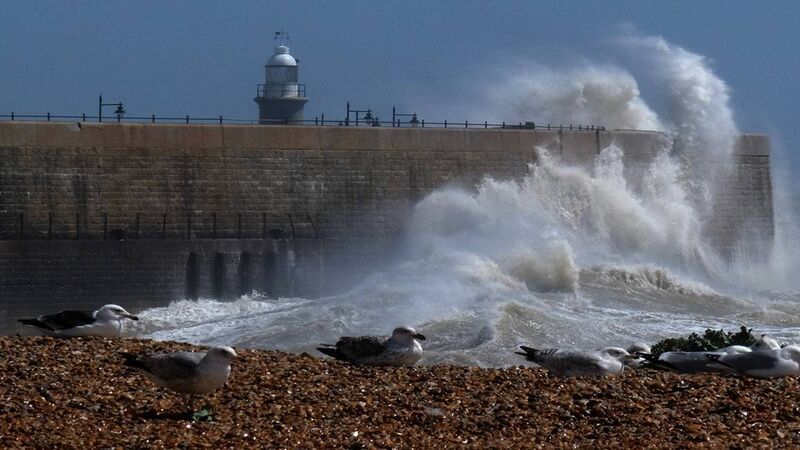
Met Éireann says that Storm Agnes could potentially bring flooding and power outages as well as create difficult travelling conditions. Picture: Larry Cummins

Forecast

Met Éireann says it will become wet and very windy on Wednesday with "outbreaks of heavy rain extending nationwide with the likelihood of some spot flooding." 

It will become extremely windy or stormy for a time in the east and south with the potential for "severe and damaging gusts".

"Strong onshore winds and high seas will bring the risk of coastal flooding on eastern and southern coasts," Met Éireann said. 

It should remain windy on Wednesday night with strong and gusty winds gradually easing as Storm Agnes tracks towards Scotland. 

"Outbreaks of heavy rain in the northeast will give way to a mix of clear spells and scattered showers," the national forecaster added. 

Thursday should see bright spells and scattered showers in the morning before a band of heavy rain moves eastwards in the afternoon. 

Met Éireann says it will become "largely dry and clear on Thursday night with just a few isolated showers in Atlantic coastal counties."

Check out the Irish Examiner's WEATHER CENTRE for regularly updated short and long range forecasts wherever you are.

More in this section

Lunchtime News

Newsletter

Keep up with stories of the day with our lunchtime news wrap and important breaking news alerts.

Cookie Policy Privacy Policy Brand Safety FAQ Help Contact Us Terms and Conditions

© Examiner Echo Group Limited