New maps show Irish coastline in unprecedented detail

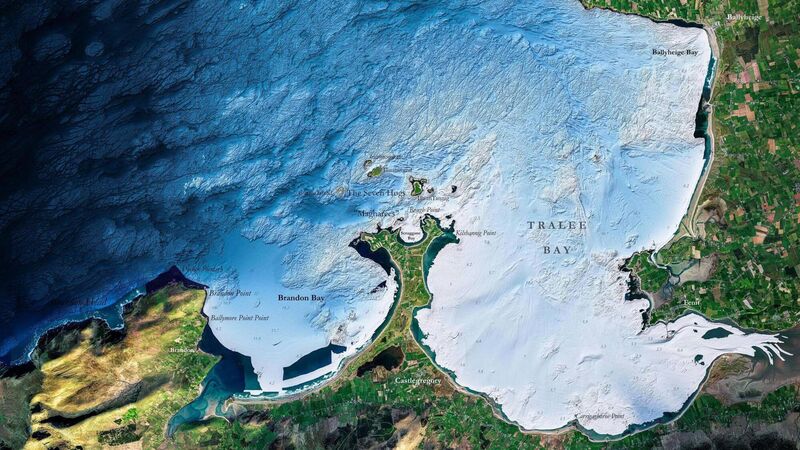
The Blue Scale Map Series "highlight the unique and intricate landscapes that lie beneath the waves" in areas such as Cork, Kerry, Waterford, Galway, Wexford, and Donegal, according to the Marine Institute. Picture: INFOMAR (Integrated Mapping for the Sustainable Development of Ireland’s Marine Resource)
Painstakingly detailed record-taking of Irish waters going back nearly 20 years has resulted in a new series of maps showing the national coast in unprecedented detail.
Released over the coming weeks, the new high-resolution maps "highlight the unique and intricate landscapes that lie beneath the waves" in areas such as Cork, Kerry, Waterford, Galway, Wexford, and Donegal, according to the Marine Institute.


