Kerry sets out plan for tackling climate change
The risks to Kerry of climate change are starkly outlined in a document which goes on public display this week.

Kerry sets out plan for tackling climate change

The risks to Kerry of climate change are starkly outlined in a document which goes on public display this week.

The county already gets some of the highest rainfall levels in the country and regularly records the highest national rainfall extremes —nine of the 12 highest monthly rainfall totals recorded since 1942 have been in Kerry.

A coastal area with three peninsulas, it also has 6,446km of rivers amounting to 9% of the total river length in the State, along with several large lakes.

Global warming is exacerbating the natural vulnerability of Kerry and, beginning in the mid-1980s, patterns of coastal storms and flooding along with extreme heat and extreme cold have emerged, according to the tables outlined in Kerry County Council’s Draft Climate Change Adaptation Strategy.

The abandonment of some of the more rural areas in Kerry because of climate change is a real prospect as isolation due to damage to roads, snow, floods, and other events increases.

Scientific evidence for warming of the climate is unequivocal,” states the report to the members of the council, which until recently included Danny Healy-Rae, a great critic of the theory of climate change.

Local authorities like Kerry will be bulwark and the first line of response to continually rising seas and rivers, snow, wind, floods, and summer drought increase.

The Kerry strategy will be part of the national strategy for climate adaptation between now and 2024.

The plan prepared over a number of months sets out the categories of infrastructure, welfare, and coastal and river protection that will need to be put in place addressed over the next number of years.

The risks to public health and safety, as well as to the tourist county’s economy, are large. As well as three peninsulas and almost 700km of coastline, centres of population like Dingle, Kenmare, and Tralee are actually perched on the coast, as are some of the county’s historical monuments.

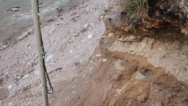
Before the national conversation, Kerry has been hit already with some dramatic evidence of climate change. The sandspit at Rossbeigh split in 2008, and the roads on the cliff overlooking Rossbeigh have also been affected.

There has been a rapid increase in invasive species thriving in the warmer, moister climate.

Coastal storms, with surges and flooding and erosion devastating property, infrastructure, and heritage have emerged as the main category of extreme weather over the past 10 years in the Kingdom, according to the strategy.

Extreme rainfall at local level brought severe flooding to Kerry in December 2015 when three of its largest towns, Tralee, Killarney, and Kenmare, were badly affected.

The hurricane damage to buildings, forestry, and trees in February 2014 is also referenced as is the massive flooding and blocked roads in October 2017.

But drought is also a problem. “The most recent high temperature and drought conditions of summer 2018 impacted on growing rates of food and water availability,” says the document.

Works have already been undertaken in Kerry — the road at Inch overlooking the Dingle peninsula has been underpinned and renewed, flood embankments have been built in Currow in mid-Kerry to protect the whole village, and the battle has begun against invasive species like roadside Japanese knotweed.

But all of Kerry’s piers, greenways, bridges, and its whole of the9,500km of roads in the county will need to be reviewed and other public areas to see how well they are able to withstand extreme weather.

The plan is on display until August 15 at Room 115, Kerry County Buildings, Tralee.

x

More in this section

Lunchtime News

Newsletter

Get a lunch briefing straight to your inbox at noon daily. Also be the first to know with our occasional Breaking News emails.

Cookie Policy Privacy Policy Brand Safety FAQ Help Contact Us Terms and Conditions

© Examiner Echo Group Limited