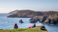
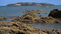
Islands of Ireland: Cattle cross to graze on Inishleigh at low water
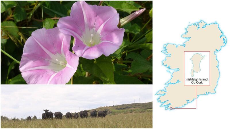
Sea bindweed and grazing cattle on Cork's Inishleigh Island
There are no ruins or any contemporary houses on this island in Roaringwater Bay in West Cork, which is surprising considering its flatness and considerable shelter which it would have afforded to anyone wanting to live there. Just prior to the Famine there were 5,000 people living on the islands in the bay: Cape Clear had close to 1,300 and Sherkin had around 1,200. All the midsize islands had plenty of people too, Heir Island and Long Island had about 350 people each; Western Skeam and Eastern Skeam had about 30 each.
However, no one lived on Inishleigh despite its good soil and closeness to shore? Hard to believe, but evidently the case. The island is situated just to the east of Turk Head. There are several other uninhabited islands scattered around including Jeremiah’s Island, Aghillaun, the exotically named Catalogue Islands, and Quarantine Island (which was used as a quarantine station for animals and people destined for Baltimore).
Inishleigh’s chief interest lies in its location on a border of sorts. This is, the often vague, position of the island straddling the maritime and riverine worlds. In Inishleigh’s case this is where the River Ilen, which begins its existence on the slopes of Mullaghmesha Mountain, outside Dunmanway, before flowing through the village of Drimoleague and on through the glorious countryside at Betsboro and on to the lovely market town of Skibbereen. From there, the river, by now wide and sluggish, flows ever onwards past the famous Skibbereen Rowing Club which has produced several Olympic champions, past the boatyard of Hegarty’s at Oldcourt, past the rustic island of Inishbeg and on to meet the sea at Roaringwater Bay. And Inishleigh is the island where river and sea are deemed to meet.
About three-quarters of the island lies in the river and a quarter is in a maritime environment determined by a line drawn to the northern tip of Spanish Island. So, in a sense, part of the character of Inishleigh is formed in a mountain range almost 40km away. The river is tidal up to the area near Kennedy Bridge and the Skibbereen Heritage Centre.
About the only geographic feature of interest on Inishleigh is a small saltmarsh — these are often found at the mouths of rivers and effectively have a foot in both camps, sea and river. This interzonal region attracts a plentiful supply of shellfish and Inishleigh is no different in this regard.
The decision on where to establish the extent of the river came about following an investigation by the Irish Fishery Commission in 1878. The delineation of the extent of the river could have been made a little further upstream at Ringarogy or further out at Sandy Island as the mixture of freshwater flowing from the land and salty seawater swirl all about. A crucial reason given at Skibbereen courthouse for choosing Inishleigh was the abundant catches of salmon and trout there — and for that reason the bulk of Inishleigh was included within the range of the river.
The island is a sizeable 13 acres and about half of it is arable. It is also very close to the mainland and is separated from it by a narrow channel of the Ilen. At low water however, cattle can cross the short distance to the island for grazing.
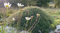
Roaringwater Bay’s islands are regarded as botanically rich and include species found nowhere else in the country such as slender centaury (Centaurium pulchellum) found on Horse Island. And other species include chamomile, yellow bartsia, and lesser skullcap. For its part, Inishleigh, along with Cape, Sherkin Long Island, and Skeam East can boast “the beautiful pink trumpets of the coastal sub-species of hedge bindweed that decorate damp hedges and shingle shorelines”, writes botanist Tony O’Mahony.
Inishleigh’s name derives from the Irish ‘Inis Liath’ meaning ‘Grey Island’ or ‘Grey Horse Island’. The island’s highest point is only 7metres above high tide and if truth be told, is a little unspectacular. Though, try telling that to the grey seals which loll oblivious on its gravel shore and on the other small islands around it.
baltimoreseasafari.ie or kayak from Turk Head or Baltimore.
: Inquire with: , Tony O’Mahony, Collins Press; logainm.ie