Islands of Ireland: An island hiding away in the Kerry mountains
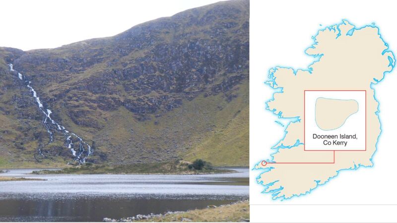
Dooneen Island, Lough Adoon, Dingle Peninsula, County Kerry. Picture: Dan MacCarthy
Islands can be found in the most unexpected places. Having surveyed the coastline zealously for hidden islands it is a joy to discover one hiding away in the mountains. Bullock Island in West Cork lies in an area very hard to reach and is all the more pleasurable to land on for its remoteness. Other islands in the upper reaches of the River Lee were also great to find.
As the road on the northside of the Dingle Peninsula to the Conor Pass begins its ascent there is a magnificent valley away to the south (left). A look at archaeology.ie reveals a map with so many red dots — each representing a monument — as to suggest an outbreak of measles. This is the Ballysitteragh-Beenoskee mountain range and glacial lakes dot the landscape like huge teardrops.
The mountains tower above the lake creating a natural barrier to the southside of the peninsula: Slievenalecka, to the south, comes in at 458m; Slievenanea to the southwest, at 670m; and Sliabh na nGabhar to the east at 485m.

Such are the prehistoric riches there that it could be named Monument Valley. It is filled with standing stones, corballed huts, fulacht fiadh, a wedge tomb, and a fort. There are examples of rock art also recorded in the area — and though these are much harder to locate, they are none the less impressive for that. The art is composed of a set of recurring motifs and consist of “shallow depressions called cup marks, cup and ring designs, grid patterns, and meandering grooves. Numerous suggestions have been made as to the function of the phenomenon, ranging from religious symbols to maps of the heavens,” writes Michael Connolly.
On the far side of the Scorid river which flows from the lake is Ballyhoneen Wedge Tomb which has rock art of a style common in Galicia. “Legends of Ireland’s past suggest that the Milesians may have been the people that arrived to Ireland from Iberia, and their distinct style marks their migration across Europe,” writes castlegregory.ie
The structures in the valley date from the late Bronze Age and up to the early Christian period. The original set of monuments suggests a sophisticated community living in the valley with associated rites and social structures.
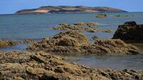
At the head of the valley a thundering waterfall crashes into a lake where our island is to be found. The lake is called Loch a’ Dúin (Lough Adoon) or the Lake of the Fort. Dooneen Island for its part is the Island of the Small Fort. There is a stone fort in the centre of the lake and which is partially intact. It has the same corballed construction method as the huts on the shores. It is a significant fort with the walls more than 2m high in places and 2.5m thick and is categorised as a ringfort or cashel. The wall follows the natural curve of the shoreline and is set back about 30m from the edge.
The island can be reached by paddling from the shore when the water levels are low, about knee deep. However, in a period of wet weather the level of the lake is much higher and wading is not an option. When you consider the usually near-freezing temperature of the water there may have been method in the madness of building a fort there.
The rest of the island has marsh grass and a few holly trees, and was not deemed necessary for the construction of the defensive walls. The water on the western and southern sides is deeper and this may have been considered a sufficient defence. It certainly wasn’t because of a dearth of stone as the valley is peppered with enough stone to build 50 forts. The fort was likely to have been home to some of the lake dwellers at the time of attacks from outsiders. They would have found sustenance in a diet of fish supplemented by barley bread, berries, and roots.
: From Tralee take the N86 followed by the R560 to the junction of the road that leads to the village of Cloghane. The entrance to the valley is on the left.
Michael Connolly in , Cork University Press