'Rich vein' of silver once found on this Copper Coast island
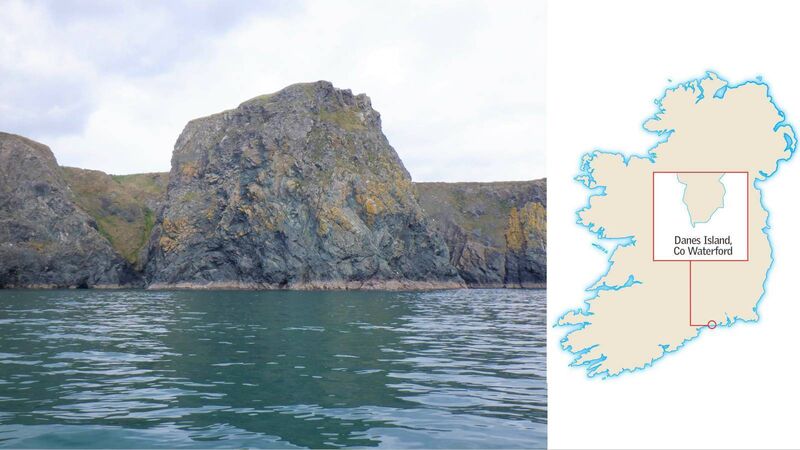
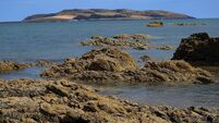
Islands of Ireland, Danes Island, Waterford. Picture: Dan MacCarthy
The spectacular coastline of County Waterford has a superb exemplar in the cliffs around Ballydowane Beach, just west of Bunmahon. Lovely beaches with golden sands, enticing caves, sea arches, and tunnels (such as at St John’s Island) add to the appeal.
The area is teeming with life avian and life aquatic illustrated by seals and otters which popped up to say hello on a recent kayaking trip.
This is Waterford’s Copper Coast named for the metal mined there since prehistory. In places, its jagged seascape shows bands of rich purples, reds, mauves, and yellows like a rainbow embedded in its towering walls.
We are used to hearing of the spectacular coastlines of Cork, Kerry, Mayo, Donegal, and elsewhere, but Waterford’s is every bit as dramatic, possibly because its wonders are unexpected. It doesn’t have the enormous peninsulas associated with these counties but its cliffs, sea stacks, and obelisks more than make up for what is quite a straight coastline overall.
Because the high cliffs are virtually unscaleable, the area attracted numerous promontory forts dating from the Iron Age (500BC to 400AD). They were built along the cliff edge on tiny promontories and in some cases, sea stacks. One such is on Dane’s Island where it must have been virtually impossible to reach.
Although, there is a story of a man once climbing the nearby tower of Carrignashagee (Cormorant’s Rock) to place a stone on top.
Yesterday we started geophysics in the fields around Illaunobrick, also known as Danes Island, at Ballynarrid, Co. Waterford. At least five eroding #promontoryfort within a 400m stretch of coastline. pic.twitter.com/E9ncjxp98x
— Edward Pollard (@EJDPollard) July 25, 2019
The forts could be easily defended from the sea and were virtually impregnable. If the enemy managed to circle around from high ground then it was a different story.
Almost all traces of these promontory forts are now gone but many are recorded on archaeology.ie. Mostly, just a low earthen embankment is all that is left of what was once a much larger structure.
While Danes Island is in fact attached to the mainland, thus rendering it null and void as an island — it is described on archaeology.ie as having an ‘impassable rock isthmus’. About 90% of Dane’s Island is surrounded by the sea and it may be this sense of separateness that gave it its identity.
Certainly, viewed from the vantage point of the cliffs it very much appears as an island. Just along the coast is Slippery Island which is most definitely not an island.
Archaeology.ie records two sites on Dane’s Island. The first is an arrangement of earthworks on the landward side, which was marked on the 1840 Ordnance Survey map but which had disappeared by 1906.
The interior of the island (as it is very small anyway, this is not too far from the cliff edge) was surveyed by renowned antiquarian, TJ Westropp, in the early 20th century — he wrote extensively on promontory forts. He recorded a number of hut sites on Danes Island.
It also has mineworks but all its features are now inaccessible, says archaeology.ie. This may well be a reference to a ‘rich vein’ of silver which was found on Danes Island. Lead was also mined there and evidence of the mines can be seen on the cliff faces in the form of manmade holes.

Danes Island is also known as Illaunobrick, or Island of O’Bric, named after a medieval Waterford dynasty. This name was not recorded until 1841 and prior to that it was called Inesbric and Hillabrug. In the 1930s it was known as Island Ivrick.
It’s not clear where the Danes came into the picture — but mythically, the island was a beachhead for the Danes when they roamed Ireland's coast for a few hundred years. However, this was at least several hundred years after the construction of the forts and it may be that a Danish party occupied the forts for a period.
Their presence is noted in folklore where the only light they had to work the mines was by using herring oil. And “It is said that anyone who passes by at night can see a lighted herring”.
: No ferry. Kayak from beach at Ballydowane.
‘Coastal Erosion and the Promontory Fort during Late Iron Age, County Waterford for the discoveryprogramme.ie