Islands of Ireland: A bluish and Greenish island
The precise extent of the Shannon Estuary even found its way to court
Islands of Ireland: A bluish and Greenish island

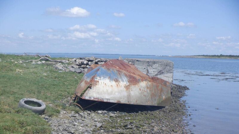
Greenish Island on the River Shannon near Askeaton, Co Limerick. Picture: Dan MacCarthy

The question of exactly where an estuary starts and a river begins is open to interpretation. The River Ilen at Skibbereen, Co Cork is considered to have reached its geographical end at Inishleigh near Turk Head where it can be said the estuary starts.

The case of the mighty River Shannon and its estuary has concentrated the minds of various geographers, cartographers and legal minds over the years. The matter even found its way to court in Limerick City in 1863 when the Fishery Commission attempted to define its precise location in order to better declare its orders over its valuable salmon fisheries.

A Mr Longfield QC quoted from Johnson’s and Crabb’s dictionaries to show the meaning of the word ‘estuary’ which he argued referred to an arm of the sea in which the tide ebbed and flowed. He submitted that the mouth of the Shannon was situated between Loop Head and Kerry Head to further up at Kilcredane Point and a point on the opposite shore.

Dan MacCarthy: 'It is unpopulated today but must have been an idyllic setting for its occupants, the Blackwells.'

An argument was made by a witness, a William Coghlan, who claimed he could walk across at half tide to Greenish Island and that this was the start of the estuary. Another witness was of the view that the estuary began at Bunratty.

The court heard “the inquiry was not one to determine what was the popular idea concerning the mouth of the Shannon, not to determine what was its geographical position, not to adopt the language of instruction of charts or sailing orders, but to define for fishery purposes within the meaning of the Acts of Parliament in force for regulating the salmon fisheries of Ireland”.

Greenish is one of the several islands in the Shannon Estuary with Little Greenish Island an island in its own right. It lies just east of the Aughinish Alumina plant and opposite the vast estuary of the River Fergus. It has a few small neighbouring islands including Curmweela which is a glorified mud bank. Greenish by contrast has rich farmland nourished by centuries of fine alluvial soils. The nearby White Island was reclaimed to the mainland.

It is unpopulated today but must have been an idyllic setting for its occupants, the Blackwells. There are a number of ruined farm buildings in the centre around which multiple head of cattle graze.

It is a low-lying, peaceful place from where the Blackwells would have observed ships sailing from the sea up to Limerick City. Several islands along the estuary (Quay Island) were home to pilots whose knowledge was in great demand to bring ships safely past mudbanks and rocky outcrops to the city.

In 2017 Sharon Slater for limerick.ie recorded the recollections of life on the river of Harry Blackwell whose forebears lived on Greenish Island.

“My granduncles Robert and Jim they were pilots for the river Deel and they used to bring up the schooners then up to Gort, navigate up the river because as you can understand the captain of a ship coming up, of a schooner, coming from anyplace else wouldn’t know the local area.” The Deel is a meandering tributary of the Shannon which joins the bigger river near Askeaton and Greenish Island.

“They were farmers on Greenish Island and they were fishermen as well, you know. Like at that time fishing was a living 
 they had to go and fish because you can understand everything was scarce at that time, money was scarce. They used to fish for flat fish and salmon.” Being opposite the Fergus Estuary and its plentiful populated islands, there was a lot of contact between them and Greenish, says Harry. “There was very good interaction between Greenish Island 
 and the islands over, Coney Island, Horse Island, Canon Island and Low Island.” Greenish has an unusual circular fortification in the southern part of the island which archaeologists have identified as a ‘fosse’. This would date it to the late medieval period. An identical structure lies east across the estuary at Saint’s Island. It was possibly associated with a fort on the southern tip of the island.

How to get there: Kayak from Deel boat club near Askeaton, Co Limerick. Privately owned.

x

More in this section

Revoiced

Newsletter

Sign up to the best reads of the week from irishexaminer.com selected just for you.

Cookie Policy Privacy Policy Brand Safety FAQ Help Contact Us Terms and Conditions

© Examiner Echo Group Limited