The Islands of Ireland: Tinkering with the past on Tinker’s Island in West Cork
It can be considered offensive by some but generally the word ‘tinker’ is not considered rude says the Traveller’s advocacy group Pavee Point. Over time the term became synonymous with ‘Traveller’ and it is this which is current today.

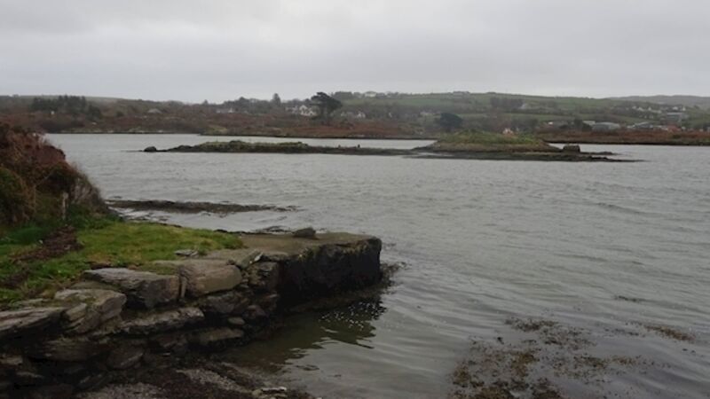
That an island was named after one anonymous ‘tinker’ is a testament of sort to their noble heritage. Tinker’s Island in West Cork is a satellite of the comparatively huge Ringarogy Island which is connected by causeway to the mainland.

The tinkers who travelled the roads of Ireland for hundreds if not thousands of years perfected the art of ironmongery by mending pots and pans, kettles and farm tools . They left a rich culture behind them, including ballads as performed by such as Pecker Dunne who once lived up the road from Tinker’s Island at Skibbereen.

It is reported locally that Tinker’s Island was so named because a ‘tinker’ was buried there. If this is correct it is likely the interment dates from the Famine years when many tinkers plied their trade.

However, no trace of the person’s name remains. They are memorialised by his or her ethnicity in the island’s name.

However, there is a much more ancient presence on this minute island which measures a mere 50m by 30m. A megalithic passage tomb dating from around 2,500 years ago was discovered by Baltimore locals Robert and Beibhinn Marten in 1993. It is one of around 300 such tombs in Ireland, the most famous of which is at Newgrange, Co Meath. The Martens reported their discovery to the Archaeology Department at UCC and later a team led by Elizabeth Twohig inspected the site.

A degree of uncertainty attends the actual position of this island. In the 1888 Ordnance Survey map it is identified as the small island adjacent to the causeway which leads to Ringarogy.

It was not named in the 1837 maps lending credence to the story of the ‘tinker’ burial. In fact it lies just north of the double island of Illaunattin distinguishable among all the low-lying islands by its coniferous trees. The entire area is a giant mud bath when the tide is fully out and lies in what geographers term ‘a lag’ which is a low-lying area susceptible to tidal influx.

The mudflats provide a sumptuous dinner for the many species of birds which find the resident worm population too delectable to resist. You will espy, depending on the season: golden plovers, lapwing, oystercatcher, dunlin, turnstone, whimbrels and curlews and even the glossy Ibis as recently recorded by @corkbirdnews.

There is an ancient presence on the minute island, a megalithic passage tomb dating from around 2,500 years ago.

There is not much left of the 5m mound that had enclosed the tomb which has a chamber 3m in length and 1m wide. Twohig formed the opinion that entry to the tomb may have been arranged due to the differently-sized orthostats (stone blocks). Unlike Newgrange, the Tinker’s Island tomb was not orientated to the sun to capture the solstices. She writes that the nearest passage tomb to it is the one at Cape Clear Island and another similar one can be found at Tramore, Co Waterford.

The majority of these types of tombs are in the north of the country. Archaeologists have speculated that the concept came from Brittany on a recognised sea route. They are prevalent on the western seaboard of western European countries. Passage tombs are one of four types of major megalithic burial types in Ireland and were used to inter someone of tribal importance usually a clan leader. The others are wedge tombs, court tombs, and dolmens.

The other major consideration relating to the Tinker’s Island tomb is sea level. A rising sea level probably inundated the tomb causing it to be suffocated with mud and draped with seaweed. Twohig writes: “Of course this landscape is a present-day one. When the tomb was built in the Neolithic the shoreline would have been much lower than at present.”

Beyond the causeway to Ringarogy the sea joins the River Ilen which wends its way to Skibbereen and further north to the hills of Dunmanway.

How to get there: The island can be seen from the causeway to Ringarogy off the Skibbereen to Baltimore road.

Other: paveepoint.ie; An Inter-Tidal Passage Tomb at ‘The Lag’, Ringarogy Island, Co Cork; Elizabeth Shee Twohig; Archaeology Ireland, Vol. 9, No. 4, 1995

x

More in this section

Revoiced

Newsletter

Sign up to the best reads of the week from irishexaminer.com selected just for you.

Cookie Policy Privacy Policy Brand Safety FAQ Help Contact Us Terms and Conditions

© Examiner Echo Group Limited