Major changes to BusConnects Cork plan unveiled but residents still object
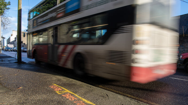
The compulsory acquisition of private gardens along most of the routes will still be required, the NTA has confirmed
Major changes to BusConnects Cork plan unveiled but residents still object

Residents on the Douglas Road have already rejected the revised plans for their street. Picture: Dan Linehan

The National Transport Authority (NTA) insists it can still deliver a faster and more reliable bus service in Cork City even with the major changes it is unveiling on Thursday to its network of sustainable transport corridors (STC) proposed under a €600m public transport plan.

The authority has bowed to public pressure and dramatically reduced the amount of tree felling, land take and on-street parking required for the STCs — the most expensive part of BusConnects Cork.

But the compulsory acquisition of private gardens along most of the routes will still be required, the NTA has confirmed.

Residents on the Douglas Road have already rejected the revised plans for their street where despite their requests for the NTA to consider alternatives, road widening will require the removal of 183 trees, some dating from the 1870s, and several boundary walls, many dating from 1810.

Ronan Margey, a representative of the Douglas Road Environment, Heritage and Community Group, dismissed the concessions the NTA has made to the design proposals along their historic street.

“We feel the current plan is basically an unnecessary road widening plan that maintains the status quo for road use,” he said.

“It will destroy the heritage of the area, it will ruin the visual character of the road and change nature of the neighbourhood.” 

The revised designs have emerged following NTA meetings with 35 resident, special interest and business groups, and with 130 individual landowners since the publication last June of the draft plans for 12 STCs across the city to deliver 93kms of bus lane or bus priority lane and 56kms of cycle lanes.

The NTA said this “extensive engagement process” has resulted in a number of revisions to the STCs, including: 

  • STC A - Dunkettle to City: The extent of the BusConnects scheme has been reduced, with the section between Dunkettle Roundabout and the Millennium Gardens to be separately developed by Cork City Council.
  • STC B - Mayfield to City: Revised traffic arrangements are proposed to operate during peak hours only at Ballyhooly Road / Glen Avenue junction, restricting through traffic movement at these times and reducing traffic congestion on this radial corridor. This arrangement enables the removal of the previously proposed bus lane on Summerhill North.
  • STC C – Blackpool to City: Spring Lane to be closed to traffic at Railway Bridge except for pedestrians and cyclists.
  • STC D – Hollyhill to City: The extent of bus lanes along Harbour View Road has been reduced, significantly decreasing overall property impacts. The previously proposed bus gate on Cathedral Road is no longer included.
  • STC E - Ballincollig to City: The bus gate previously proposed in Ballincollig Town Centre is no longer part of the scheme and additional on-street car parking spaces have been included. Various changes along this corridor, including proposed peak hours bus gates on Model Farm Road, have reduced the number of impacted properties.
  • STC F - Bishopstown to City: Cycle facilities along Glasheen Road, Cottage Mews and Schoolboy’s Lane replace the previously proposed route through Presentation College grounds.
  • STC G - Togher to City: The Pearse Road section of this corridor has been removed. Along Pouladuff Road, an inbound bus gate will operate at morning peak hours only, removing the need for the previously proposed bus lanes, thereby reducing impacts on properties and parking.
  • STC H – Airport Road to City: It is now proposed to direct cyclists from Curragh Road to Evergreen Road via a quiet street treatment on O’Connell Avenue. Replacement off-street car parking on Evergreen Road is also proposed.
  • STC I – Maryborough Hill to City: An outbound bus lane is no longer proposed on Douglas Road. To provide bus priority, a bus gate is proposed just east of the entrance to St Finbarr’s Hospital, operating during peak hours only.
  • STC J - Mahon to City: On Churchyard Lane and Boreenmanna Road, the amount of bus lanes proposed have been reduced, retaining the majority of trees and reducing property impacts. Additional off-street parking is proposed.
  • STC K - Kinsale Road to Douglas: A proposed bridge over the Mangala Valley and the Well Road Cycle Route are not included in the revised STC.
  • STC L - Sunday’s Well to Hollyhill: Sunday’s Well to Hollyhill STC is no longer being progressed as an individual scheme, with sections of the corridor being incorporated into adjacent schemes.

The NTA, in collaboration with Cork City Council, is proposing enhancements to urban spaces along some STCs including:

  • STC B - Mayfield to City: Public realm improvements for Dillon’s Cross and St Luke’s Cross 
  • STC C - Blackpool to City: Public realm works including improved and enhanced street spaces and landscaping at Blackpool village.
  • STC I - Maryborough Hill to City: Village improvement works in Douglas Village such as placemaking, landscaping, and mobility improvements.

NTA chief executive Anne Graham and its deputy chief executive Hugh Cregan announced the changes in Cork City this morning for a second round of public consultation.

Despite the significant changes, a spokesman for the NTA insisted that BusConnects Cork will still deliver an improved public bus transport system for the city.

Anne Graham, CEO National Transport Authority. Picture: Darragh Kane

“The NTA’s position throughout all of this initial phase of public consultation was to, where possible, listen to those impacted, make changes while all the time maintaining the objective of delivering a transformed public transport network and bus priority to ensure that buses are not stuck in traffic, and that they run reliably and as fast as possible,” he said.

“We believe we can still deliver on that even with the changes being announced today.” 

The revised plans are now open to public consultation for eight weeks.

BusConnects Cork : The changes in your area, in detail

STC A – Dunkettle to City 

  • The cycle and bus infrastructure linking Dunkettle Roundabout to the Port of Cork Millennium Gardens will now be delivered as part of separate projects proposed by Cork City Council. These projects include the Eastern Gateway Bridge, the Pathfinder Programme and the Tivoli Docks Development.
  • An elevated boardwalk for pedestrians and cyclists that passes on the riverside of Castleview Terrace is no longer required. Pedestrians and cyclists will instead continue along Lower Glanmire Road to connect to the new cycle route in the North Docks near the junction with Beale’s Hill. A section of inbound bus lane has been dropped and replaced with traffic light controlled bus priority to facilitate this change.
  • On-street parallel parking has been reintroduced on Water Street.

Dunkettle Interchange. Picture: Tom Coakley

STC B – Mayfield to City 

  • A bus gate has been added at the junction of Ballyhooly Road with Glen Avenue for vehicles travelling northbound. A ‘straight ahead’ restriction for general traffic will also be implemented for vehicles travelling southbound along Ballyhooly Road.
  • The proposed bus gates at New Road and Murmont Park have been removed, and the existing road layout is retained.
  • The EPR indicated that parking would be provided on the northbound side of Ballyhooly Road however in the proposed design it is intended to retain the original road layout along Ballyhooly Road.
  • The proposed bus lanes on Summerhill North have been removed (except for a short inbound section on approach to MacCurtain Street) with parking re-instated and footway widths maintained.
  • The proposed cycle tracks along Wellington Road have been replaced by a quiet street treatment.
  • Filtered permeability will be implemented on York Hill to prevent through traffic, except pedestrians and cyclists.
  • The cycle provision along Gardiner’s Hill proposed in the EPR will now be facilitated via a quiet street route along Middle Glanmire Road, Leycester’s Lane, St Christopher’s Drive and Murmont Lawn.
  • Public Realm Improvements are proposed for Dillon’s Cross and St Luke’s Cross.

STC C – Blackpool to City 

  • An additional traffic lane has been provided along Brothers Delaney Road from the junction with the N20 to the junction with Blackpool Retail Park.
  • Filtered permeability will be implemented on Spring Lane to prevent all through traffic except pedestrians and cyclists.
  • Public Realm Improvements are proposed for Blackpool Village.

STC D – Hollyhill to City 

  • The proposed cycle tracks on both sides of the carriageway along Sunvalley Drive, North Monastery Road and O’Connell Street have been replaced with a two-way cycle track along the northern side of the carriageway, which reduces the impact on mature trees and reduces the number of junction crossings.
  • The proposed bus gates at the junction of Gurranabraher Road and Cathedral Road have been removed, and the existing road layout is retained.
  • The length of segregated bus lanes along Harbour View Road has been reduced, which reduces the impact on private properties.

STC E – Ballincollig to City 

  • R608 (Old Macroom Road) on approach to Innishcarra Road: Use of signal controlled priority has removed the need for a section of dedicated bus lane and road widening. As a consequence the impacts on private properties and roadside trees have been reduced.
  • R608 between just west of Old Fort Road and Innismore Court: Increased use of signal controlled priority has removed the need for sections of dedicated bus lanes and road widening. As a consequence the impacts on private properties and roadside trees have been reduced.
  • Ballincollig Town Centre: The bus gate previously proposed is no longer part of the scheme and the number of on street car parking spaces has been increased to retain more existing spaces than previously proposed.
  • Between Old Fort Road (East) and Coláiste Choilm: Proposals for this section have been revised to reduce the length of bus lanes and extent of road widening required. As a consequence the impact on some private properties has been reduced.
  • Between Poulavone and the east of Daffodil Fields: Increased use of signal controlled priority has removed the need for sections of dedicated bus lanes and road widening. As a consequence the impacts on private properties and roadside trees have been reduced.
  • Between Rosewood and Leo Murphy Road: It is noted that the outbound bus lane was previously proposed to extend to Whitethorn Drive but has been shortened. As a consequence the impacts on private properties have been reduced.
  • Dedicated bus lanes are no longer proposed along Model Farm Road between Carrigrohane Road and Inchigaggin Lane. An inbound and outbound bus gate is proposed in lieu of physical infrastructure with bus priority secured by restricting non-essential through-traffic on Model Farm Road. The inbound bus gate would operate during the morning peak period only, while the outbound bus gate would operate during the evening peak period only.
  • A new link road connecting Model Farm Road and the N22 Carrigrohane Road is proposed to facilitate traffic diverting from the bus gate on Model Farm Road.
  • Along Model Farm Road, between Rossa Avenue and Dennehy’s Cross: Proposals for this section have been revised to reduce the length of bus lanes and extent of road widening required. As a consequence the impact on some private properties has been reduced.
  • The location of the bus gate on College Road has been moved slightly compared to the EPR and it is now located to the east of College View.
  • On Donovan’s Road it is no longer proposed to construct a new pedestrian bridge adjacent to Donovan’s Bridge within the grounds of University College Cork. In lieu of this it is proposed to restrict vehicular movement across the bridge to one-way at a time with northbound traffic giving way to southbound traffic across the bridge. This allows footpaths to be widened to enhance pedestrian facilities across the bridge.

STC F – Bishopstown to City 

  • Curraheen Road: Use of signal controlled priority has removed the need for a section of dedicated bus lane and road widening. As a consequence the impacts on private properties have been reduced;
  • Bishopstown Road: Reduction in length of dedicated bus lanes. As a consequence the impacts on private properties have been reduced;
  • Proposal for a new quiet street is proposed along Wilton Avenue, through the CUH grounds, onto Bishopstown Avenue before connecting in with STC E at Model Farm Road; • Proposal for cycle facilities along Glasheen Road, Cottage Mews and Schoolboy Lane in lieu of the previous route through Presentation College grounds;
  • New cycle route across Kingsley Bridge, through the Sacred Heart Church grounds connecting to the existing quiet street treatment on Mardyke Walk. As a consequence the impacts on private properties along Victoria Cross Road have been reduced;
  • Removal of a section of outbound bus lane on Western Road between Mardyke Walk and Gaol Walk. As a consequence the impacts on private properties have been reduced;
  • Inclusion of cycle facilities along Sunday’s Well Road by means of a new boardwalk, and Western Road by means of a new pedestrian and cycle bridge adjacent Thomas Davis Bridge. This section of STC F previously formed part of STC L.

STC G – Togher to City 

  • The corridor now commences on Pouladuff Road, just north of the junction with Pearse Road.
  • The proposed inbound bus lane on Pouladuff Road between Pearse Road and Nuns Walk is no longer proposed. Bus priority will now be provided by an inbound bus gate which will be in operation at morning peak hours only.
  • Works on Pouladuff Road have been limited, significantly reducing the loss of car parking compared to the EPR.
  • Some additional off-street parking has been proposed in the verges at Pouladuff Place adjacent to the entrance to the Soundstore yard.

STC H – Airport Road to City 

  • On the north-western arm of the Kinsale Road Junction, i.e., the arm that currently serves Harvey Norman, Smyths, etc. it is proposed to amend the location and operation of the previously proposed bus gate. The Preferred Route Option proposes that the bus gate in the inbound direction would only be operational in the morning peak periods. Furthermore, it is now proposed to move the start of the outbound bus gate to just after the northern entrance to Kinsale Road Retail Centre. This proposal would remove the need for the previously proposed right turn lane and thereby reduce the quantum of land take required in the area.
  • The EPR proposed dedicated cycle facilities along Curragh Road as far as Evergreen Road. It is now proposed to direct cyclists from Curragh Road to Evergreen Road via a quiet street treatment on O’Connell Avenue. To reduce traffic volumes on O’Connell Avenue to an appropriate level, it is proposed to introduce a modal filter just north of Derrynane Road which would remove through traffic while facilitating safer movement of cyclists and pedestrians. This proposal removes land take previously identified along Curragh Road north of O’Connell Avenue. The proposal also reduces the impact on parking along Evergreen Road.
  • A compensatory car park is proposed on lands to be acquired to the rear of number 27 and 28 Evergreen Road to offset the impact of car parking lost on Evergreen Road.
  • Bus stops, pedestrian crossings and footpaths previously proposed along the N27 at Boreenmanna Road no longer form part of the proposals. The slip lane from the N27 Southbound to Boreenmanna Road will also be retained in the revised proposals.

STC I – Maryborough Hill to City

  • On Maryborough Hill an inbound bus lane is no longer proposed between Greendale Road and The Paddocks, bus priority would instead be provided using traffic signals. As a consequence the impacts to private properties on the northern side of the road have been reduced.
  • An outbound bus lane is no longer proposed on Douglas Road. To provide bus priority, a bus gate is proposed just east of the entrance to St Finbarr’s Hospital. As a consequence the impacts to properties on Douglas Road have been reduced. The bus gate on Douglas Road near Belair Estate has been removed.
  • The bus gates that remain on Douglas Road are to be operational during morning and evening peak hours only. Motorists can drive up and down Douglas Road as normal outside of these hours.
  • Nine on-street parking spaces have been retained on Douglas Road near the junction with Belair Estate • Two-way traffic to be maintained on Douglas Road between Belair Estate and the bridge over the N27 South Link Road.
  • Two-way traffic to be maintained on Southern Road, and a bus lane removed from this road.
  • The southbound cycle lane has been reintroduced on Southern Road.

STC J – Mahon to City 

  • On Churchyard Lane and Boreenmanna Road there is now generally a bus lane proposed in one direction only. As a consequence the impacts on private properties and roadside trees have been reduced.
  • Some additional on-street parking spaces have been retained. New off-street parking spaces are proposed close to Ballinlough Pitch and Putt and also near the entrance to Rockboro Primary School.
  • The bus gates will only be active during peak hours. Outside of these hours cars can use Avenue de Rennes in both directions as normal.

STC K – Kinsale Road to City 

  • Ballybrack Woods/Mangala Valley: A proposed bridge over the Mangala Valley connecting Grange Road to Carrigaline Road is not included in the revised proposals for the Kinsale Road to Douglas Sustainable Transport Corridor as part of BusConnects Cork. The delivery of the Southern Distributor Road connecting Rochestown /Douglas to Grange/ Frankfield and onwards to Sarsfield Rd remains a longer-term objective of the Cork Metropolitan Area Transport Strategy. STC K is now routed via Donnybrook Hill and Church Street.
  • Well Road: Well Road is not included in the revised proposals for the Kinsale Road to Douglas Sustainable Transport Corridor as part of BusConnects Cork. The delivery of the improvements for pedestrians and cyclists on Well Road remains a longer-term objective of the Cork Metropolitan Area Transport Strategy.
  • Ballycurreen Road / Grange Road / Donnybrook Hill: Increased use of signal controlled priority has reduced the need for dedicated bus lanes and road widening on Ballycurreen Road, Grange Road and Donnybrook Hill. As a consequence the impacts on private properties, car parking and roadside trees have been reduced.
  • An additional pedestrian crossing has been included on Ballycurreen Road close to the new western bus stops.
  • An additional signalised crossing is proposed on Grange Road close to the Church of Incarnation to enhance connectivity to the Elmwood Medical Practice and the Grange Road/Tramore Valley Park Pedestrian and Cycle Link.
  • A new ‘pedestrian and cyclist only’ link is proposed to connect Donnybrook Hill with Westbrook Gardens and Ballybrack Greenway. A new signalised crossing is proposed on Donnybrook Hill close to the access junction for Inchvale Road.

More in this section

Puzzles logo
IE-logo

Puzzles hub


Puzzles logo
IE-logo

Puzzles hub


logo podcast

War of Independence Podcast

A special four-part series hosted by Mick Clifford

Available on
www.irishexaminer.com/podcasts

IE logo

Commemorating 100 years since the War of Independence

Cookie Policy Privacy Policy FAQ Help Contact Us Terms and Conditions

© Irish Examiner Ltd