Cork street closed following overnight 'tornado-like conditions' 
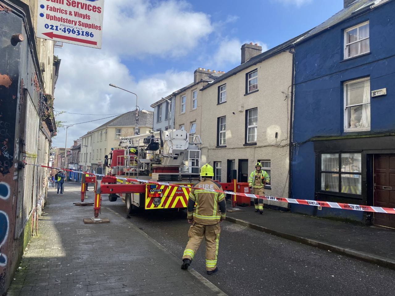
Barrack St was closed to traffic after the stormy conditions caused notable damage to houses along the footpath
Barrack St was closed to traffic after the stormy conditions caused notable damage to houses along the footpath.

Barrack St was closed to traffic after the stormy conditions caused notable damage to houses along the footpath.

A busy street in Cork city was closed until Thursday afternoon following damage from tornado-like conditions last night.

Barrack St was closed to traffic after the stormy conditions caused notable damage to houses along the footpath.

A Fire Brigade spokesperson told the Irish Examiner there was an issue with loose slates on one of the houses due to a suspected lightning strike last night.

The section of the street surrounding the affected house is fully closed, with no access to pedestrians while work is ongoing.

The Fire Brigade is in the process of removing any remaining slates before the road is re-opened to the public.

The road was due to re-open by 1pm.

Union Quay in Cork City on Thursday morning. Picture: @clairenichan on Twitter

Reports of flooding were rife across Cork city on Thursday morning, following heavy overnight showers.

Widespread flooding was reported along the quays shortly after 6am, with traffic delays along Union Quay as a result.

Severe winds overnight have caused speculation there was a "small tornado" in the county.

A spokeswoman for Met Éireann said the "low pressure systems" residing above the North Atlantic at the moment may to be blame.

Breaking down last night's weather, she said: "Last night around 9pm we got a line of thunderstorms which moved into West Cork."

This was followed by a "band of heavy rain" in North and East Cork which persisted from midnight until 2am.

According to the weather expert, the band had the appearance of Mesoscale features, describing storms or thunderstorms, leading her to believe "it's not far from impossible that it would have been tornadic".

The section of the street surrounding the affected house is fully closed, with no access to pedestrians while work is ongoing.

She said there is a "lot of instability over Ireland at the moment".

"Showers that are around at present have the potential to turn very heavy and even thundery," she added.

Heading into Friday, she describes the air as looking "quite similar", and warned about "deceptive" blue skies.

Met Éireann has predicted "gusty" overnight conditions, with lowest temperatures of 3C to 6C expected.

Friday promises widespread heavy showers, which may lead to "potential wave overtopping" along the west and southwestern areas.

Mild temperatures are promised with mercury highs of between 8C and 12C throughout the day.

Check out the Irish Examiner's WEATHER CENTRE for regularly updated short and long range forecasts wherever you are.

More in this section

Lunchtime News

Newsletter

Get a lunch briefing straight to your inbox at noon daily. Also be the first to know with our occasional Breaking News emails.

Cookie Policy Privacy Policy Brand Safety FAQ Help Contact Us Terms and Conditions

© Examiner Echo Group Limited