Met Éireann extends overnight status yellow ice warning to entire country
Met Éireann extends overnight status yellow ice warning to entire country

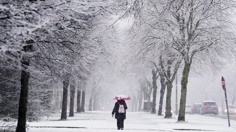
A person uses an umbrella for shelter on Griffith Avenue as snow falls on the Northside of Dublin. Picture: Brian Lawless/PA Wire

A weather warning has been issued for every county tonight after sleet and snow led to travel disruption in some parts of the country earlier today.

Met Éireann has said temperatures could fall to as low as -2C overnight, leading to ice developing on untreated surfaces and hazardous travelling conditions.

The status yellow ice warning for the entire country came into effect at 6pm. It will remain in place until 9am on Saturday morning.

A separate yellow rain warning in also place for Dublin, Louth, Meath and Wicklow and will expire at 3am on Saturday. Until that time, Met Éireann says there is a risk of localised flooding in affected areas.

The forecaster said scattered showers will develop in the west and north overnight, some of which could  turn into sleet in the by morning, particularly in the northwest. Temperatures will range between -2C to 2C tonight, with some icy stretches forming.

From early Friday morning, snowfall was reported in several counties, causing widespread travel disruption and the closure of some schools. 

Iarnród Éireann said some DART trains for commuters around Dublin were delayed on Friday, with the suspension of services between Lansdowne and Bray.

It also said that a tree fell on overhead power lines near Merrion Street.

There were also long delays from Heuston to Westport and Heuston to Galway.

Some Bus Éireann services to and from Dublin from Donegal and Cavan were also cancelled because of bad weather, as well as services between Cavan and Dundalk.

 Heavy snowfall in Newbridge in Co Kildare on Friday. Picture: Eamonn Farrell/RollingNews.ie
Heavy snowfall in Newbridge in Co Kildare on Friday. Picture: Eamonn Farrell/RollingNews.ie

Dublin Bus said its 44B route from Glencullen was curtailed due to the weather.

Speaking this morning, Brandon Craig, meteorologist at Met Éireann, said that a rain warning was issued on Thursday afternoon but it was predicted that snow would fall on higher ground only.

He said that snow is “notoriously difficult” to predict.

“It wasn’t clear until this morning that it was going to be as heavy as it is and as widespread,” Mr Craig told Radio One.

“The model had the freezing levels too high up over hills and higher areas but it turns out that… complex dynamics pushed the snow down further than what it should have and that’s what led to the lying snow over most areas.

“There was a signal for snow but it was over higher ground to the north.

Walkers brave the cold conditions during Friday's snowfall in the Phoenix Park, Dublin. Picture: Naoise Culhane

“Snow is notoriously the most difficult in meteorological parameters to forecast in Ireland. If we had a crystal ball and we knew exactly what was going to happen maybe that would have been an orange warning but given the risk at the time we don’t take our warnings lightly at all.

“We can’t over-warn otherwise people won’t believe the orange warnings when they come. The warnings that were put out were based on the most accurate evidence at the time.”

Flights into and out of Dublin were also delayed throughout Friday.

x

Check out the Irish Examiner's WEATHER CENTRE for regularly updated short and long range forecasts wherever you are.

More in this section

Lunchtime News

Newsletter

Keep up with stories of the day with our lunchtime news wrap and important breaking news alerts.

Cookie Policy Privacy Policy Brand Safety FAQ Help Contact Us Terms and Conditions

© Examiner Echo Group Limited