Storm Eunice has potential to be a 'multi-hazard and disruptive event'
Storm Eunice has potential to be a 'multi-hazard and disruptive event'

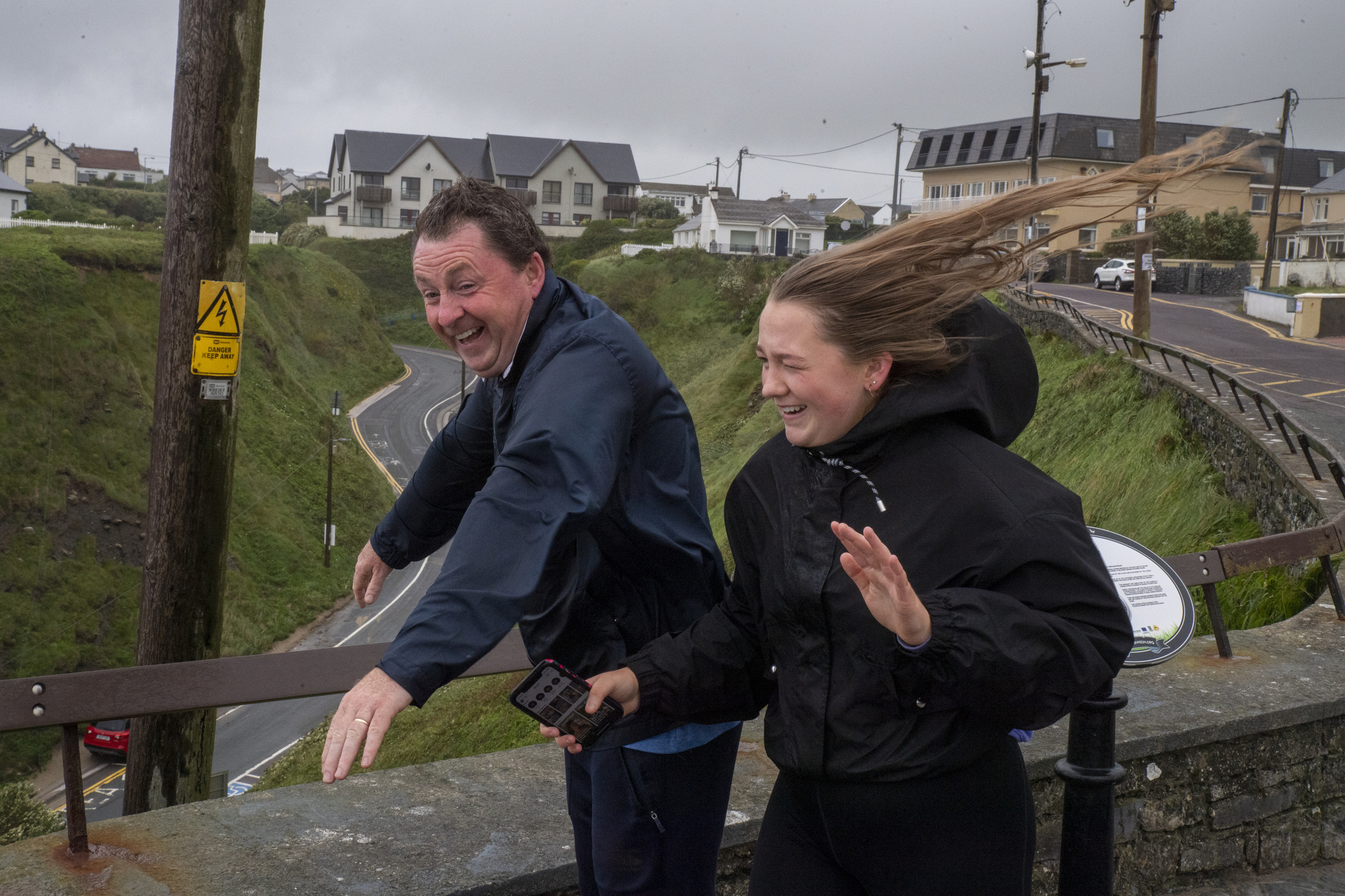
Storm Dudley will see mean wind speeds of between 65 and 80km/h with damaging gusts of 100 to 130km/h, which will be stronger on exposed coasts and on high ground. Picture: Domnick Walsh

A crisis management team met today to discuss preparations for storms Dudley and Eunice.

The National Directorate for Fire and Emergency Management (NDFEM) spoke with Met Éireann, the Office of Public Works (OPW), local authorities and key departments.

The storms are expected to impact Ireland tomorrow and Friday and weather warnings have been issued across the country.

The NDFEM Crisis Management Team will continue to work with Met Éireann to monitor the evolving weather situation It intends to conduct further meetings of the group over the coming days.

Storm Dudley is expected to arrive on Wednesday, to be followed by Storm Eunice, which is expected to land on Friday.

Both storms will bring strong and damaging winds and Met Éireann has issued some weather alerts ahead of their arrival.

Storm Dudley will see mean wind speeds of between 65 and 80km/h with damaging gusts of 100 to 130km/h, which will be stronger on exposed coasts and on high ground.

A status yellow wind warning has been issued for the rest of the country. It will come into place at midday on Wednesday and remain in effect for 24 hours.

The national forecaster says the country is in for "a very unsettled week ahead with the weather expected to cause some disruption at times".

The UK Met Office has issued an amber warning for counties Antrim and Derry, while a yellow warning will be in place for counties Antrim, Armagh, Down, Fermanagh, Tyrone and Derry.

There may also be some coastal flooding in areas due to a combination of high tide and strong winds.

Through Thursday night and into Friday morning, Storm Eunice will track eastwards over the country.

In a weather advisory for the whole country, Met Éireann said Storm Eunice has the potential to be a "multi-hazard and disruptive event with damaging winds, heavy rain and snow possible".

The strongest winds are most likely to affect southern counties and the most significant falls of snow are most likely over central and northern parts of the country.

Disruption to travel is likely across the country.

On Friday morning, Met Éireann forecasts a more widespread spell of windy and disruptive weather as Storm Eunice moves across the country. It expects to issue weather warnings for this storm in the coming days. Sleet showers and snow flurries can also be expected.

"It's been a fairly quiet year so far but that's all going to change this week as an active jet stream steers several low-pressure systems across Ireland and the UK," said Emer Flood, Met Éireann meteorologist.

“On Wednesday, Storm Dudley will bring strong winds to mainly northern and western areas, these strong winds in combination with high tides will lead to large coastal waves and some coastal flooding.” 

As the first storm clears, Thursday morning will see winds ease for a time before picking up again with the approach of Storm Eunice.

We’re keeping a close eye on this storm as there is the potential for more widespread strong winds across Ireland which may lead to some disruption and damage.

"Along with strong winds, Eunice is expected to bring spells of heavy rain and potentially some snow."

The public are advised to keep a close eye on the weather forecast. Met Éireann said warnings will be issued on Wednesday morning and updated on Thursday morning.

It will remain very unsettled for the weekend, with strong and blustery westerly winds feeding in plenty of showers across the country on Saturday and Sunday. 

The showers will be heavy at times too, particularly on Sunday along Atlantic coastal counties.

RSA advice

Road users should also take extra care when crossing the road or cycling in windy conditions as a sudden gust of wind could blow them into the path of a vehicle. Picture: Domnick Walsh 

The Road Safety Authority is asking road users affected by the orange warning to check local traffic and weather conditions before setting out on a journey.

The following advice is being given to motorists:

  • Control of a vehicle may be affected by strong crosswinds, especially on exposed routes such as dual carriageways and motorways. High-sided vehicles and motorcyclists are particularly vulnerable to strong winds.
  • Beware of objects being blown onto the road. Expect road conditions to change quickly in high winds so reduce your speed.
  • Watch out for falling or fallen debris on the road and vehicles veering across the road.
  • Drivers should allow extra space between themselves and vulnerable road users, such as cyclists and motorcyclists as they may be blown off course by strong winds.
  • Drivers need to slow down in wet weather conditions, to avoid the risk of aquaplaning. Drivers should also leave a bigger gap between themselves and the vehicle in front.
  • If the road ahead is flooded, choose another route. Flooded roads that appear shallow could be deeper than you think. They may also have trees or branches that have fallen that may not be visible.
  • Road users should always follow recommended routes and obey signs closing roads to traffic.
  • After going through water, drive slowly with your foot on the brake pedal for a short distance to help dry the brakes.
  • And finally, drive with dipped headlights at all times.

Pedestrians, cyclists and motorcyclists in the affected areas have been urged to postpone their journey until conditions improve.

As visibility and light are reduced in poor weather conditions, wearing bright clothing with reflective armbands or a reflective belt is important. 

Road users should also take extra care when crossing the road or cycling in windy conditions as a sudden gust of wind could blow them into the path of a vehicle.

Walk on a footpath, where possible and look out for falling debris from above, especially in urban areas.

Pedestrians should walk on the right-hand side of the road, facing traffic if there are no footpaths.

For more weather updates, visit Met Éireann’s website.

x

Check out the Irish Examiner's WEATHER CENTRE for regularly updated short and long range forecasts wherever you are.

More in this section

Lunchtime News

Newsletter

Keep up with stories of the day with our lunchtime news wrap and important breaking news alerts.

Cookie Policy Privacy Policy Brand Safety FAQ Help Contact Us Terms and Conditions

© Examiner Echo Group Limited