Oldest map of Ireland on sale for €3m
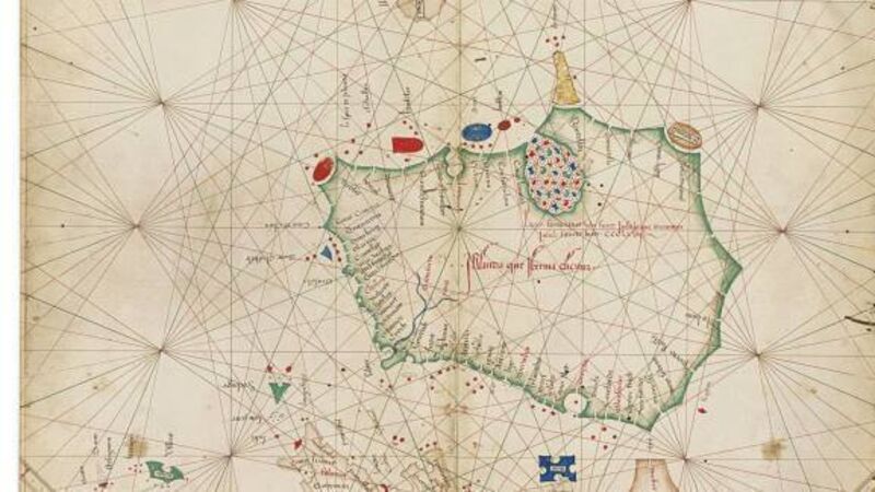
If your sat nav is a bit out of date or Google maps ain’t your thing, a cool €2m to €3.2m could net you the oldest known standalone map of Ireland.

Oldest map of Ireland on sale for €3m

That’s the auction estimate on an almost 450-year-old atlas by Italian cartographer Grazioso Benincasa going under the hammer in London later this month.

As the oldest known individual map of this island, not depicted alongside Britain, it was produced — according to the Benincasa’s signature — in 1468.

Already a subscriber? Sign in

You have reached your article limit.

Unlimited access. Half the price.

Annual €130 €65

Best value

Monthly €12€6 / month

More in this section

Lunchtime News

Newsletter

Keep up with stories of the day with our lunchtime news wrap and important breaking news alerts.

Cookie Policy Privacy Policy Brand Safety FAQ Help Contact Us Terms and Conditions

© Examiner Echo Group Limited