Satellite imagery reveals scale of destruction to Ukrainian city of Mariupol

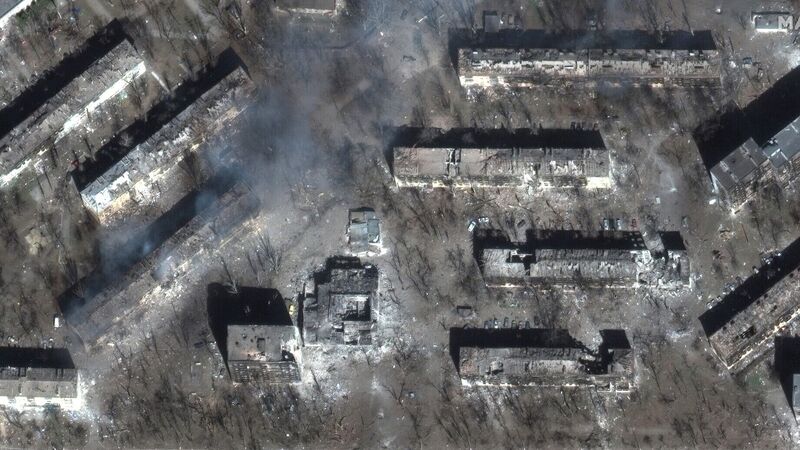
Damage to residential buildings seen in Mariupol (Satellite image ©2022 Maxar Technologies/PA)
New satellite imagery has revealed the scale of damage to the Ukrainian city of Mariupol amid Russia’s invasion of the country.
The imagery, captured on Tuesday by Maxar Technologies, a geospatial intelligence company based in the US state of Colorado, includes a before and after comparison showing buildings damaged and destroyed, with debris and wreckage strewn across roads.


