Satellite images show extent of air pollution around the world

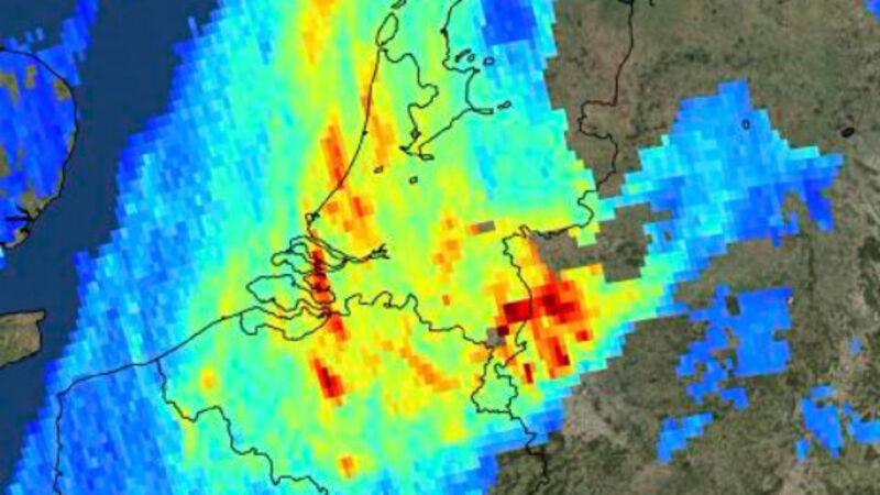
Images taken by a new European satellite show the levels and distribution of air pollutants around the world, including ash spewing from a volcano in Indonesia.
The European Space Agency released images made by its Sentinel-5P satellite that also show high concentrations of nitrogen dioxide in parts of Europe on November 22.


