Roads reopened following flooding in Cork city but extreme caution still advised

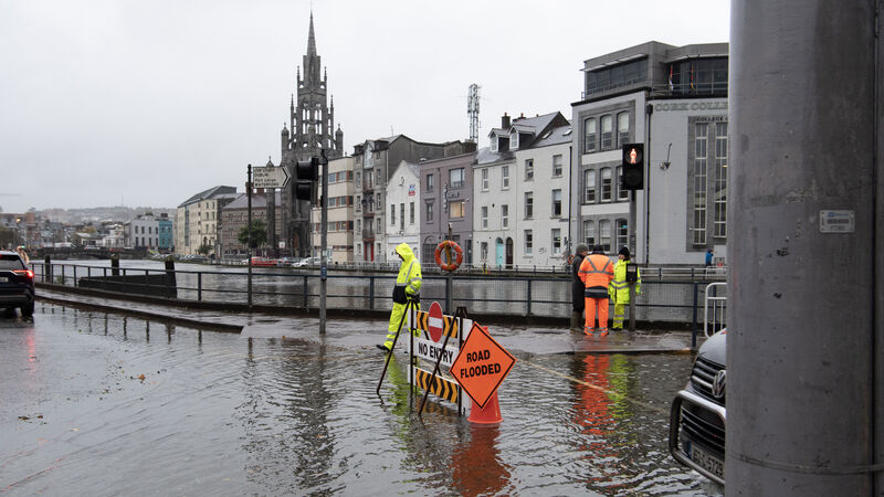
No entry to Union Quay beacuse of flooding in Cork. Picture: Dan Linehan
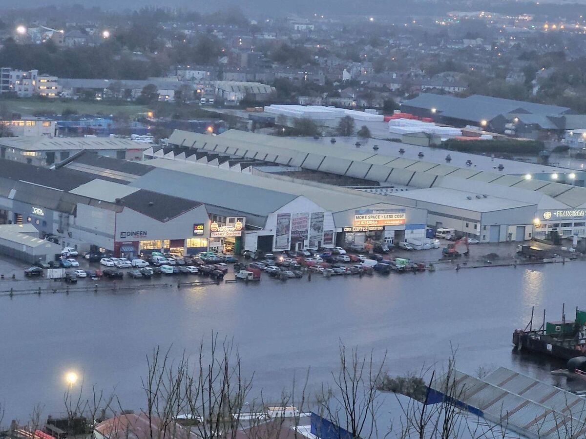
Parts of Cork experienced flooding on Monday as high tide hit the city.
Cork City Council advised "extreme caution" for flooding in areas of the city centre from high tide and over the coming days.
Monday's high tide caused widespread flooding in low-lying areas of the city which will impact on traffic flow.
At 6.30pm, Cork City Council advised that all roads have reopened.
People are still being advised to be extremely cautious on the roads as localised flooding is still causing some disruption.
As high tide hit the city at around 5pm, flooding was causing disruption to traffic in areas including Lower Glanmire Road, Wandesford Quay, Morrison's Island and Father Matthew Street.
The cycle lane on South Mall is flooded and traffic on South Terrace and Lavitt's Quay were reduced to one lane with Gardaí on hand direct traffic.
The city and county remain under a status yellow wind warning since 11am this morning, along with five other counties.
Andranik Kazarian — who rents a parking space near French’s Quay in the city, which flooded on Monday evening — said that he does not think there is much that can be done to stop the flooding.
“It’s not the first time it’s happened here,” he said, as he rolled up his trousers to wade through the flood waters to his car.
“Nothing can be done about it, I think. You cannot prevent water coming here.”
The flooding is “not too scary”, he said, adding that he wades through flood water to his car around twice a year.
“It’s my choice to park here. If I had a feeling it would get damaged, I wouldn’t park here.”
A local shop owner, Kieran O’Sullivan, said where he is on French’s Quay seems to escape the flooding.
“It’s strange, I think we’re just that bit higher,” he said. “We’re lucky!”
A delivery Mr O'Sullivan was expecting on Monday evening was postponed due to flooding. He said it is frustrating to see the same spots flooding every year.
He said he was worried about flooding, but after 40 years on the Quay he’s hopeful the shop will escape any damage in the future.
“It’s hard not to be concerned with the height of the water and the generally heavy rainfall,” one woman said, moments after clambering over some floodgates into her office on O’Sullivan’s Quay.
She said the flooding is frustrating, but she was “very anxious to maintain the historical façade of the riverside”.
She said she would prefer to engage in flood protections like the barriers at her office, “rather than erect a barrier on the side of [the Lee]”.
Meanwhile, high tides over the coming days will cause localised flooding and disruption to traffic, the council has warned.
The following areas have been highlighted as at-risk areas for flooding later today:
- South Mall (South Side)
- Morrison’s Quay
- Union Quay
- Lower Glanmire Road
- Horgan’s Quay
- Fr. Matthew Quay
- Trinity Bridge
- Union Quay
- Sharman Crawford Street
- Wandesford Quay
- Frenche’s Quay
- Proby’s Quay
- Crosses Green
- Lavitt’s Quay
- Kyrl’s Quay
- South Terrace
- Rutland Street
- Sawmill Street
Businesses, property and home-owners in these areas have been urged to take appropriate measures to protect their premises.

Meanwhile, Kerry is the latest Munster county to fall under a weather alert, as a status yellow rain warning came into effect at 5am this morning.
The warning will be in place until 9pm tonight alongside a status yellow wind warning which covers Cork, Waterford, Carlow, Kilkenny, Wexford and Wicklow from 11am today.
"Spells of heavy rain at times today may lead to localised flooding," said Met Éireann. "Highest rainfall amounts in mountainous areas."
Counties under the wind warning can expect a "spell of very strong and gusty southerly winds" that will track eastwards today.
"Damaging gusts of up to 110 km/h are possible," it was added.
This morning will be "cloudy and breezy with outbreaks of rain, heavy at times, especially in the southwest", Met Eireann said.
The forecaster said, "more rain will spread eastwards across the province with localised flooding possible" today.
"It will become very windy also with strong, gusty southerly winds, strongest in the south. The rain will clear eastwards this evening and winds will ease."
Check out the Irish Examiner's WEATHER CENTRE for regularly updated short and long range forecasts wherever you are.


