Met Éireann's new warning system to include detailed explanations of colour alerts

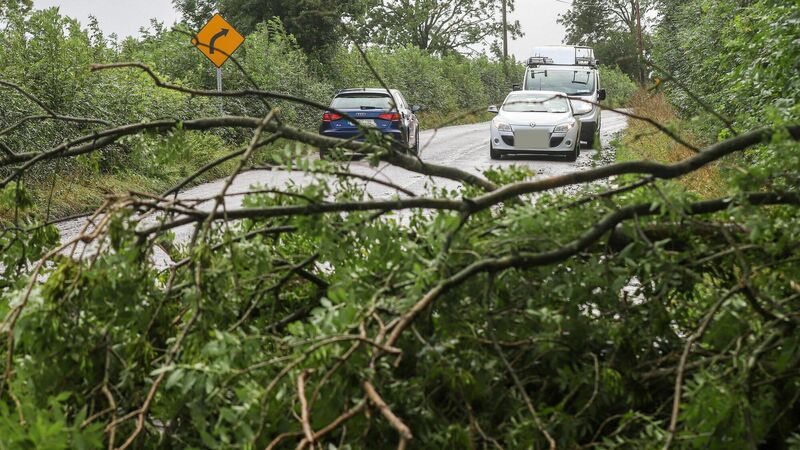
Motorists contend with downed trees outside of Fermoy in Co Cork following storm Ellen in 2020. A revised warning system by Met Éireann details how wind speeds will now be increased by around 5kph before a yellow warning will be issued.
Met Éireann is planning a new weather warning system to take account of higher wind speeds, rising temperatures in a warming climate, as well as specific concrete examples of what people can expect to happen based on their colour-coded alert system.
The meteorology service has been criticised over its yellow, orange, and red warning system with some members of the public suggesting alerts are unnecessary while at other times people claimed they were not given sufficient warning of potential damage.
A revised warning system, a copy of which was released under FOI by Met Éireann, says wind speeds will now be increased by around five kilometres per hour before a yellow warning will be issued.
Where previously, ten minutes of gusts between 50 and 65 kph would be enough to trigger a yellow warning, that will be reset at between 55 and 65 kph to help avoid the risk of unnecessary alerts.
There has also been changes made to what will trigger a warning about low temperatures.
Up to now, an alert would be issued if it was expected to drop to -3C; however, that has been revised to minus two degrees according to the draft plan.
Similar changes were made for more severe orange and red warnings for low temperatures, with new limits being set based on the impact of the climate crisis on Ireland.
Met Éireann said a further review of rainfall thresholds is also being examined but will not form part of the new alert system, which is to be published in the first quarter of this year.
The biggest change to the system is more detailed explanations of what can be expected from each warning, with input from agencies like the ESB sought.
For a red wind warning with winds consistently above 80kph, damage to buildings, fallen trees, treacherous travelling conditions, and danger to life were all considered potential impacts.
In severe snow, people could expect unsafe outdoor working conditions, danger to life, cancelled transport services and outdoor events, severe damage to crops, and the potential for supplies to run short.
The impacts expected from a high-temperature red warning would include severe drought, higher risk of forest fires, difficult sleeping conditions, and increased presentations at emergency rooms from those suffering the effects of heat.
A spokeswoman for Met Éireann said the 2023 review had been intended to ensure the warning system was “reflective of the weather we experience in the context of changing climate” and was based on analysis of their climatological database.
She said: “The updated warnings guidelines will now also include the ‘potential impacts’ associated with each hazard and colour code.
“This is in line with best practice, as outlined by the World Meteorological Organisation. It is hoped that these updates will go live in Q1 of 2024.”
Check out the Irish Examiner's WEATHER CENTRE for regularly updated short and long range forecasts wherever you are.


