Ireland's rich list 1911: New online census documents show stark inequality a century ago
Ireland's rich list 1911: New online census documents show stark inequality a century ago

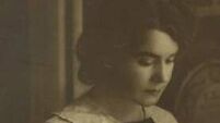
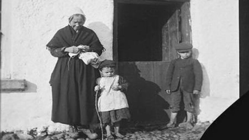
One of the pictures used by the CSO from the Clonbrook Photographic Collection c1900 to illustrate its new online collection 'Stories from Census 1911: Wealth and Poverty'. Picture courtesy of National Library of Ireland

If you were to be part of the wealthy elite more than 100 years ago, Co Meath was the place to live, according to a new analysis.

Data collated by the Central Statistics Office (CSO) from the 1911 census paints a picture of the haves in the eastern part of the country, while the have-nots toiled away in the west, with those in Co Mayo eking out a particularly difficult existence, at least when it came to having money.

According to Stories from Census 1911: Wealth and Poverty, — a collection of newly-digitised documents from that year’s census — the most lavish lifestyles of the rich and famous were likely to be found in Culmullin in Dunshaughlin, Co Meath.

The CSO calculated that it was the district electoral division (DED) with the highest valuation per person of £20, 19 shillings and five pence, or £20.97.

The CSO's new map of Ireland showing wealth and poverty by county in 1911.  

HISTORY HUB

If you are interested in this article then no doubt you will enjoy exploring the various history collections and content in our history hub. Check it out HERE and happy reading

Statistician Emer Crowley said nine of the top 10 wealthiest counties in 1911 were in Leinster and seven of the 10 poorest counties were towards the West. Some eight of the top 20 wealthiest DEDs were in Meath alone, while eight of the 20 poorest DEDs were in Donegal.

In contrast to Culmullin in Meath, Glenties in Co Donegal was the division with the lowest valuation per person of four shillings and seven pence, or £0.23, illustrating the vast inequality gap in Ireland more than 110 years ago.

Ms Crowley said: “There are many stories hidden in this data and this release looks at valuation per person as an indicator of wealth in 1911. This data could also be used to look at population density, construction levels, and other demographic change factors.

“The Census of Ireland 1911 is the first publication in this initiative where a selection of tables has been digitised. We were able to use population and valuation statistics published in The Census of Ireland 1911 to gain insights into wealth and poverty in the country at that time.

“It was notable that poverty along the western seaboard was more acute when compared with the rest of the country, and particularly when compared with counties in Leinster.”

The CSO used a case study for a Culmullin household in 1911 for the series.

St Patrick’s Street, Cork, in 1911. Newly-digitised CSO data shows no part of Munster featured among the wealthiest areas of Ireland — but Munster did not feature among the poorest either. The data indicates that 11 of the 20 poorest district electoral divisions were in Connacht.

“In the Census of Ireland, 1911, the Gaisford household was recorded as living in Culmullin DED, Meath. The Gaisford household consisted of five people — a married couple (Douglas and Elizabeth Gaisford) and three servants (Sarah Browne, Fanny Ashell, and Emily McIlray).

“Their house had 21 rooms along with 13 outhouses and farm steadings. Douglas Gaisford is also listed as the landholder for three other houses on associated returns. The Census returns for the other three houses contain occupation descriptions such as gardener, coachman, or general labourer — presumably for persons employed by the Gaisford household,” it said.

That household’s fortunes are contrasted with those of a family in Donegal.

“The Duffy household was recorded as living in Annagary DED, Donegal. The Duffy household consisted of 11 people with the head of family, Grace Duffy, listed as a farmer’s wife. There were nine children aged from 18 down to one-year-old and a grandmother aged 73.

“Their house contained just two rooms along with one outhouse or farmsteading. This household Census return records the roof of this house as being of ‘Thatch, wood or other perishable material’ while the walls were of ‘stone, brick or concrete’,” the CSO said.

The stories are part of the CSO’s historical statistics recovery (HSR) initiative which began in 2022 and is driven by volunteers in the organisation.

In Cork, living in Mallow was your best bet to be wealthy, the area coming in 18th place out of the top 20 in 1911. It was the only Cork area to make the top 20.

Dublin, 1911: The newly-digitsed CSO data shows the city's South Ward was the only part of the capital among the top 20 wealthiest areas in Ireland. File picture: Topical/Getty  

Only Dublin City’s South Ward made it into the top 20 from the capital.

Outside of the eight wealthy divisions in Meath in the top 20, the remaining 12 were in Kildare with three, Laois, then known as Queens County with two, Westmeath with two, and one each in Belfast city, Cork, Dublin city, Dublin county and Roscommon.

While Munster lacked in rich areas, it did not feature among the poorest either. According to the data, out of the 20 poorest DEDs, 11 were in Connaught while none were in Munster.

The CSO cautions that valuation per person, “is an indicator only and should not be interpreted as a precise measure of wealth”.

The numerator ‘valuation’ only relates to land and buildings and where they are geographically located, it said.

“However, it is reasonable to consider that wealth in 1911 primarily consisted of land and buildings that wealthy persons owned land and they resided on that land. Therefore, valuation per person, while not a direct measure of wealth, is a good indicator of wealth in a geographic area,” it added.

More in this section

Lunchtime News

Newsletter

Keep up with stories of the day with our lunchtime news wrap and important breaking news alerts.

Cookie Policy Privacy Policy Brand Safety FAQ Help Contact Us Terms and Conditions

© Examiner Echo Group Limited