Latest: Prepare for snow and sub-zero temperatures, Met Éireann warns
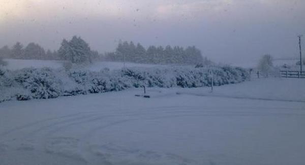
Latest: We are being told to prepare for snow and sub-zero temperatures overnight.

Latest: Prepare for snow and sub-zero temperatures, Met Éireann warns

Update 10.10pm: We are being told to prepare for snow and sub-zero temperatures overnight.

Met Éireann have also issued a Yellow Alert weather warning for winds reaching up to 110 km/h over the next 24 hours.

Motoring groups are also warning drivers to take extra care as not all roads will be gritted.

Update 4.48pm: Met Éireann has issued a status yellow wind warning for nine counties.

It comes into place at 11pm tonight and remains until 2pm tomorrow afternoon.

The areas affected are Donegal, Galway, North Leitrim, Mayo, Sligo, Clare, Cork, Kerry and Limerick.

Southwest winds will reach up to 110km/h.

This is in addition to its previous yellow alert for snow and ice across 18 counties which will gradually clear northeastwards by morning.

File image.
File image.

Update 3.10pm: Status yellow snow and ice warning in place for 18 counties

A new status yellow snow ice warning is in place for 18 counties across the country from 4pm.

The counties affected are: Cavan, Monaghan, Donegal, Dublin, Carlow, Kildare, Kilkenny, Laois, Longford, Louth, Wicklow, Offaly, Westmeath, Meath, Leitrim, Cork, Limerick and Tipperary.

Snow accumulations of less than two centimetres are expected in these areas this evening and tonight.

Another snow-ice warning for Leinster, Cavan, Monaghan and Donegal has kicked in at 3pm with frost and ice expected.

While cold conditions are expected throughout the country.

Met Eireann meteorologist Evelyn Cusack says it is not unusual for December.

She said: "I suppose it is normal weather for this time of year.

"There is a lot of ice out there and there could be some snow showers.

Update - 10.23am: Met Eireann warns of all-day frost as they issue Status Yellow snow and ice warning

Met Eireann have issued two separate status yellow snow-ice warnings. 

Until 2pm this afternoon it is in place for Galway, Clare, Cork, Kerry, Limerick and Tipperary.

From 3pm today until 3am tomorrow morning the second warning affects Leinster, Cavan, Monaghan and Donegal.

A widespread severe frost overnight has led to icy conditions in most parts of the country and some snow showers are expected in places.

Forecaster Evelyn Cusack says extra care is needed as cold conditions mean untreated roads might now thaw out.

She said: "There may be some snow showers today, it's not going to be a widespread thing and many areas will escape, but it's going to stay cold through the day.

"On a day like this frost would stay all day in many areas, because the sun is very low down and people would want to be very cautious all day long."

6.39am - AA urges drivers to adapt to snow and ice and allow for extra journey time:

Motorists are being asked to look out for patchy accumulations of snow later today.

Met Éireann has issued a Yellow Alert with up to 3cm of snow expected to fall between 7am today and 6am tomorrow, especially on high ground.

Forecasters have predicted widespread frost and icy conditions this morning with patches of freezing fog and isolated snow showers also.

They say that patchy rain, sleet and snow will slowly extend from the south-west today.

This morning will see sub-zero temperatures that will rise only to between 1C and 5C this afternoon.

The AA's Barry Aldworth says road users should check local weather reports and be aware of conditions before setting out on a trip.

He said: "So what it means for motorists is really the importance of adapting your driving to the weather conditions, that is the first thing that people will have to take into account.

"You'll want to slow down your driving on roads affected by snow and ice and allow yourself extra journey time so that you're not panicking behind the wheel, you're not rushing and racing."

x

More in this section

Lunchtime News

Newsletter

Get a lunch briefing straight to your inbox at noon daily. Also be the first to know with our occasional Breaking News emails.

Cookie Policy Privacy Policy Brand Safety FAQ Help Contact Us Terms and Conditions

© Examiner Echo Group Limited