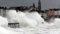
We’re not ready for a serious flooding scenario
But despite this week’s sunnier weather, many parts of Ireland are rarely more than a combination of heavy rains and high tides away from a similar scenario.
Pictures from Gloucestershire and Oxfordshire have been dramatic, and we ignore them at our peril in this country.
Despite previous occurrences — particularly in the east and south — we’re by no means ready for the worst.
It may be hard to prepare for such extremes in weather and water, but many towns and cities have barely progressed since their last bout of serious flooding.
In the most vulnerable areas, such as parts of Dublin, Cork, Bray, Arklow, Waterford and Clonmel, tidal activity has a major bearing on the flood threats, while in other areas, such as parts of Mayo, Galway, Clare, and Donegal, incidents, when they happen, are largely down to the weather.
The government introduced a National Flood Policy in 2004, with the Office of Public Works (OPW) the lead agency, charged with implementing various measures to combat flooding in those areas which tend to be the worst affected.
In recent years, some parts have had flood defence structures provided, such as Kilkenny, Carrick-on-Suir, and along the river Tolka in Dublin City.
Elsewhere, like Clonmel, Ennis, Fermoy and Mallow, work is about to start on phase one of various prevention schemes.
However, in many previously hit areas such as Waterford and Carlow, it will be next year at the earliest before work starts on proposed schemes, while planning is only getting under way for projects in Arklow, Bray, Enniscorthy, Mornington, Portarlington, Templemore, Tullamore and Tullow. Minor schemes have started on the Silleachain stream in Leixlip and similar works are due to get under way shortly on the river Rye in Leixlip and the Dodder in Sandymount.
The OPW is also working with Clare, Donegal, Galway and Mayo local authorities to find solutions to flooding problems which occurred in those counties at the end of last year. Some experimental work has been done on the Shannon Cut below Banagher in Co Offaly to try to relieve summer flooding which causes hardship for local farmers and also threatens wildlife.
According to the OPW, they are aware of up to 400 locations nationwide at risk of flooding to some degree.
“The more substantial risk areas have been prioritised for attention and it is anticipated all areas will be examined as quickly as resources allow,” said a spokesman.
Various studies are also up-and-running in an attempt to gather information about future flood risk, such as the Flood Studies Update Programme; the Strategic Hydro-meteorological Review Programme; the Flood Hazard Mapping Programme; as well as emergency response development plans and public awareness programmes.
On the European front, a Floods Directive is on the cards and this looks set to involve the identification of risk areas, as well as the preparation of flood risk management plans.
However, the regularity of serious flooding looks likely to increase.
If there are still doubters out there, look back on those pictures of the water-swept regions across the Irish Sea and think again.