What is a red weather warning and how do I prepare for Storm Éowyn?
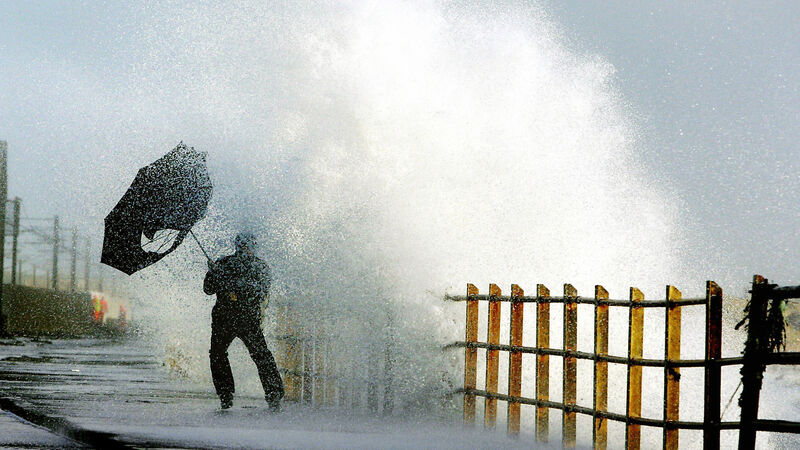
Storm Éowyn is set to sweep the country overnight, bringing with it destructive gusts in excess of 130km/h in some parts of the country.
Ireland is bracing itself for what could potentially be among the most severe storms that the country has seen on Friday.
Storm Éowyn is set to sweep the country overnight, bringing with it destructive gusts in excess of 130km/h in some parts of the country.
The entire country will be under a status red wind warning at various stages on Friday in what is expected to one of the strongest storms to hit Ireland in years.
The chair of the National Emergency Co-ordination Group said the storm will likely be among the “most severest storm” that Ireland has ever seen and people are being warned to stay indoors.
Here is everything you need to know about the storm and how to prepare.
A status red severe weather warning means ‘shelter in place’ and people in the areas affected by red warnings should stay indoors, avoid unnecessary travel, and take action to protect themselves and their properties.
Meteorologist Siobhán Ryan explains that a status red severe weather warning is rarely issued by Met Éireann, but when it is, people in the areas expected to be affected should take action to protect themselves and/or their properties.
A status red wind warning is in place for the entire country from the early hours of Friday morning. The warning will remain in place until varying times, depending on the area, up to Friday afternoon.
Met Éirerann has warned that Storm Éowyn will see gale-to-storm-force southerly winds become westerly with extreme, damaging and destructive gusts of over 130km/h in some areas.
The forecaster has warned that the storm could pose a danger to life, extremely dangerous travelling conditions, unsafe working conditions, disruption and cancellations to transport and significant and widespread power outages.
People are also advised to be wary of fallen trees and prepare for impacts to communications networks and structural damage.
Wave overtopping and coastal flooding in low-lying and exposed areas is also expected.
It is predicted that Storm Éowyn will be one of the worst-ever storms to hit Ireland, with winds being compared to those that battered the country more than 60 years ago when Hurricane Debbie struck.
Hurricane Debbie struck the country in September 1961, taking the lives of 15 people.
Winds hit a peak of 177km/h and all-time wind gusts and 10-minute sustained wind records were broken at several locations across the country.
Alan O’Reilly of Carlow Weather has said that Storm Éowyn will be “historic” and claims that weather charts are unprecedented.
Taking to X this week, he wrote: “That high resolution AROME model out to 9am shows gusts l've never seen this model show before for Ireland and this model is one of the best there is for Ireland.
“Anyone saying this is just another storm is in for a rude awakening. This will be an historic storm.” BBC Scotland weather presenter Judith Ralston described Storm Éowyn as “one major storm”.
Taking to X, she wrote: “This is one major storm. I've not seen anything like it in my career.”
With winds of up to 130km/h set to hit parts of the country, people are being advised to batten down the hatches tonight.
Those with garden items such as outdoor furniture or trampolines are advised to either store them away or secure them by tying them down.
A trip to the shops to stock up on the basics is advised this evening before the red warning comes into effect tomorrow.
With strong winds likely to cause significant and widespread power outages tomorrow, it’s a good idea to leave laptops, phones and power banks charging overnight tonight.

People should also have a torch and batteries at the ready, as well as candles and matches.
Those with outdoor pets are advised to bring their four-legged friends indoors to keep them safe from flying debris.
Experts at Petinsurance.ie have also advised pet owners to make sure their pet has a suitable, safe place to sleep inside, away from spots where the noise of the wind or draughts could make them nervous or uncomfortable.
Meanwhile, the Department of Education has instructed primary and post-primary schools to remain closed on Friday, even after the red weather warning has expired in their area.
Iarnród Éireann has also advised that no train services will operate while the status weather warning is in place on Friday morning and that significant disruption is likely afterward.
Check out the Irish Examiner's WEATHER CENTRE for regularly updated short and long range forecasts wherever you are.