Storm watch: Pictures from around the country as Storm Lorenzo passes through Ireland

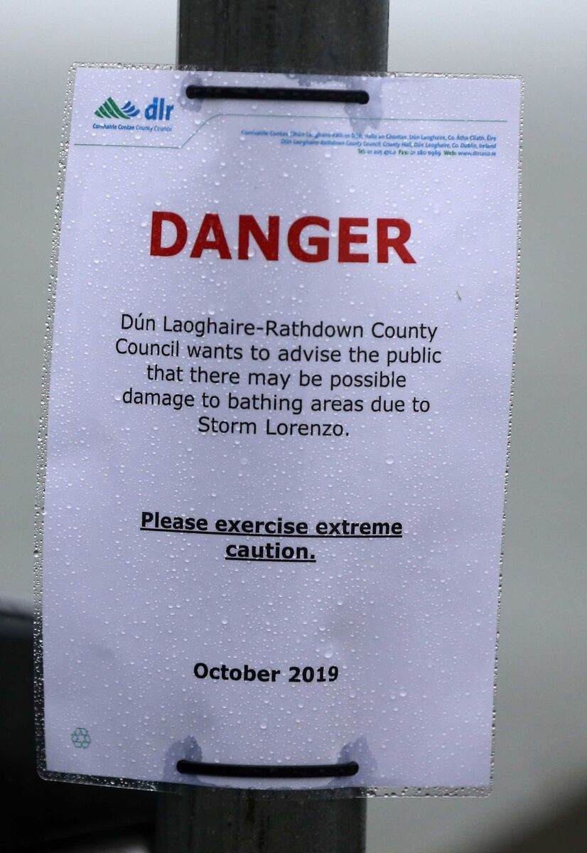
Storm Lorenzo is bringing strong winds and large waves on western and southern coasts throughout the night, with the potential for coastal flooding and damage.

Waves crashing unto Rossglass beach, Lecale, County Down. @paulmoane @newslineweather @WeatherCee @angie_weather @barrabest @geoff_maskell #stormLorenzo pic.twitter.com/TTYGacDtCO
— PAUL MOANE (@paulmoane) October 3, 2019

Fan amach as an bhfarraige. #stormlorenzo pic.twitter.com/yGE2b5gXCM
— GleoBeo (@GleoBeo) October 3, 2019


Surfers making the most of the pre #StormLorenzo conditions in Killiney in Dublin this evening pic.twitter.com/WO9fwIt0hS
— Philip Bromwell (@philipbromwell) October 3, 2019


Storm Lorenzo crashing into Inishmore Island, Galway #Lorenzo #StormLorenzo #inishmore #Galway @MetEireann pic.twitter.com/vECgDoyAGv
— Enda Mullan (@ejmullan) October 3, 2019

Orange and yellow weather warnings are in place across the country, while there is a a status orange wind warning coming into effect for Galway, Mayo, Clare, Kerry and Limerick.
1/2 Windy with scattered outbreaks of rain this evening. Strong to gale force S to SW winds with some severe gusts in coastal areas. pic.twitter.com/g7bdrPY6Cg
— Met Éireann (@MetEireann) October 3, 2019
Meanwhile Wexford, Cork, Tipperary and Waterford will come under a yellow wind warning. Both warnings are in place until 6am tomorrow morning.
2/2 Continuing very windy tonight in W & S counties with some further damaging gusts for a time, combined with very high seas. Winds will ease over northern & eastern parts. Rain overnight also, with some very heavy falls in parts of north Connacht and Ulster & spot flooding.
— Met Éireann (@MetEireann) October 3, 2019
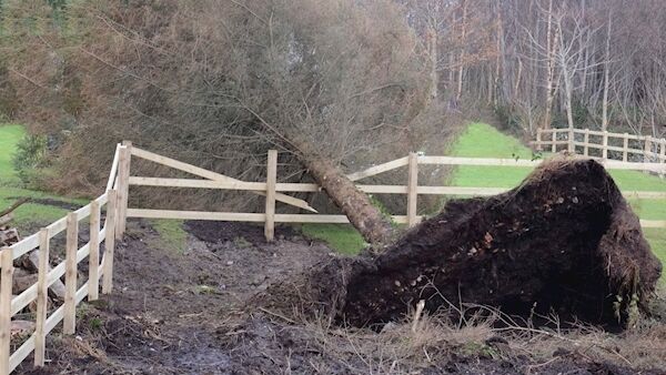
Damage to property is expected as winds reach up to 130 kilometres per hour.

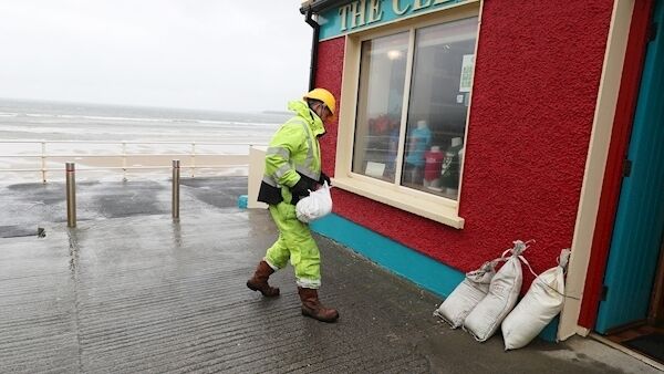
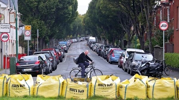
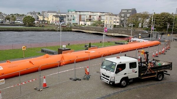
Storm defence preparations have been ongoing across the country today.

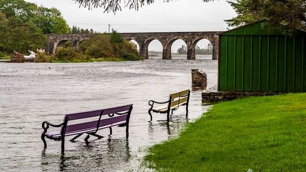
Flooding can be expected across Connacht, Leinster, Cavan, Monaghan and Donegal as a status yellow rain warning is in effect until 6am tomorrow morning.
Our latest visible satellite image of #stormlorenzo off the west coast of Ireland. Warnings for #lorenzo are available on https://t.co/oOxITrsnvw as well as our mobile apps on both IOS and android platforms. pic.twitter.com/9bX5EOVyJ7
— Met Éireann (@MetEireann) October 3, 2019
Minister for Housing Eoghan Murphy says people in these counties should take particular care.
Irish Coast Guard teams have so far responded to 6 incidents today 🚨
— Irish Coast Guard (@IrishCoastGuard) October 3, 2019
With the worst of the weather still to arrive please heed the warnings and stay away from exposed coastal areas. 🌊🌊💨💨 #Lorenzo pic.twitter.com/WibUsMisTu
"Kerry, Limerick, Galway, Mayo and Clare are still under orange, and that warning has been extended in time.
"A status orange is a serious condition: it may pose a threat to life and safety.

"All of the country will experience this storm, but the effects will be different in different parts of the country.

"Our primary concern since Tuesday, and it remains our primary concern, is the west and north-west coasts".
Every stormy cloud has a silver lining! We're delighted to facilitate this Airbus A330-800 NEO test aircraft today! It's in from Toulouse to test cross wind landing due to the high winds! New aircraft since the Concorde have used Shannon at some stage for testing #stormLorenzo pic.twitter.com/foVC9rBWkx
— Shannon Airport (@ShannonAirport) October 3, 2019
Check back throughout the evening for more updates.


CONNECT WITH US TODAY


Be the first to know the latest news and updates


