Michael Moynihan: Old carvings a true benchmark for a proper reading of Cork city
Michael Moynihan: Old carvings a true benchmark for a proper reading of Cork city

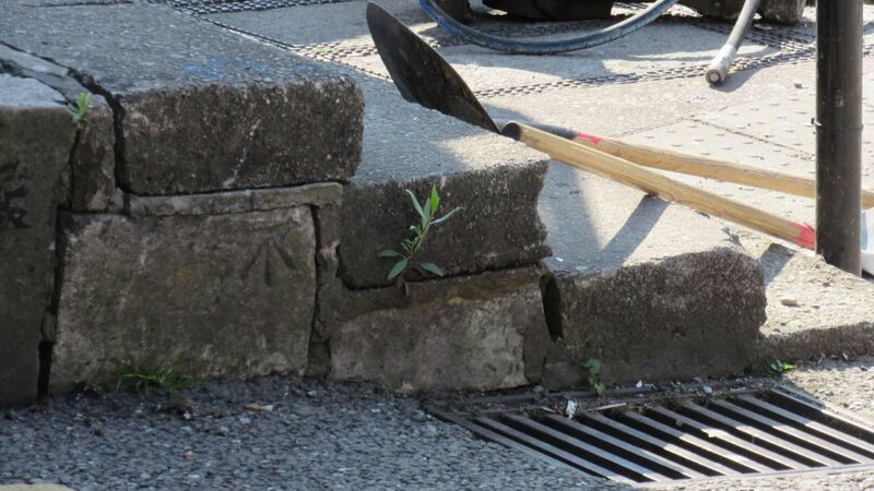
The benchmark stone on the kerb at the base of St Patrick's Hill. (Pictures: Twitter Tony McGrath @SignsTheReading)

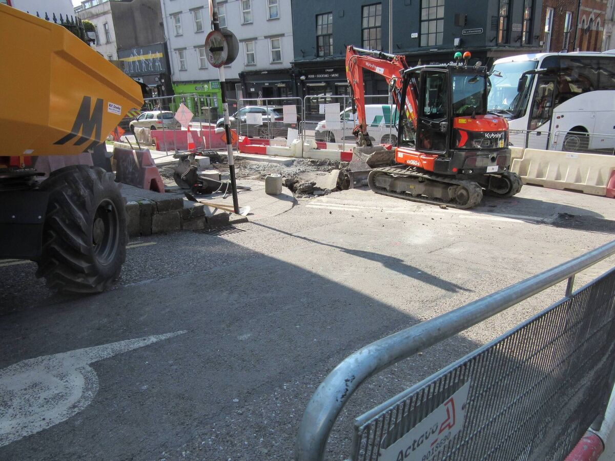
A few weeks back there was a bit of a stir when attention was drawn to the loss of a benchmark (which has since been reinstated), a carved wall marking, due to works at the bottom of Patrick’s Hill.

Tony McGrath was the man who spotted the original removal, and as a quantity surveyor with a fascinating blog — readingthesigns.weebly.com — I thought he might educate me on benchmarks. And benchmarks in Cork, in particular, those funny symbols with lines pointing towards them.

“The benchmarks set a level, which are obviously important in building and surveying.

“People might ask what the British ever did for us, but the British army made us the best-mapped country in the world because of the Ordnance Survey. The Duke of Wellington’s brother was the head of the Ordnance Survey — he was a Wellesley, by the way, hence Welleseley Terrace and Wellington Terrace up off Patrick’s Hill.”

The surveyors worked their magic through triangles, he adds.

HISTORY HUB

If you are interested in this article then no doubt you will enjoy exploring the various history collections and content in our history hub. Check it out HERE and happy reading
“Once you have a triangle, with its lengths and angles, then you can work everything out. The triangle doesn’t have to be horizontal on a plane, either, so that’s how they mapped hills and mountains.

“If you go to the top of a lot of mountains in Ireland you’ll find trig points there — points the OS used to map as the basis of triangles which measured distances on those maps.”

And the benchmarks were part of that orderly system. In Cork, they had to be checked for settling, for instance, because the city is on a marsh.

“Someone would be sent around to check and would report the mark at the bottom of Patrick’s Hill had settled by an inch, for instance. Because of that, the map of Cork ought to have been subject to more revisions.

“I remember getting a phone call once from The Echo asking what the rise in Patrick’s Hill was — they were using Tour de France terminology and they wanted to determine the exact incline.

“If you went to an old map — on Historicmaps.ie or OSI.ie — you could find the level of the benchmark at the bottom of Patrick’s Hill — which was removed in those works — and one at the top at Bell’s Field. You could look at the map then and determine the hill goes up 100m in 200m distance, and then all you need is Pythagoras’ theorem to work out the rise.”

'You see them everywhere'

Thus the practical application of the benchmark. But simply spotting them is fun in itself, says McGrath.

“Once you start looking for them, you see them everywhere.

“If you go into an old map on one of those websites I mentioned, they’ll show the benchmarks. Go to a Cork map on those sites and blow it up and you’ll see there’s a benchmark on Patrick’s Hill. There’s another one by Skerry’s College. There are loads of others.

“You get to a stage where you can predict where you’ll find one, and you’ll begin to expect them. Limestone piers at a gate entrance? You’d be surprised if they don’t have them. They’re not all the same, either — in Waterford they have a dot rather than a mark, for instance, a cast-iron dot, but I don’t know why it’s different there.

“I spotted another one in Cork lately at the top of the wall on Pope’s Quay, between the location of the old toilets, which are gone now, and the new footbridge.

“Then, up in the old cemetery in Mount Farran, there are different marks. Three lines going up to a horizontal bar, but the cemetery marks have WD or WDBO — War Department or War Department Board of Ordnance, no 5 or 6 or whatever.”

This goes back to another British Army tendency — as McGrath says, they were great to map out their own territory.

The benchmark stone on the kerb at the base of St Patrick's Hill, Cork.

“Those WD marks aren’t benchmarks, which are a representation of a horizontal level — WD is a representation of a vertical level, as in ‘this is the boundary of our property’.

“It’s a similar principle. A neighbour of mine in Sydney Park showed me a mark on his wall, WD no. 6 FW but it had an arrow pointing outwards to 5 and then CW, and another arrow pointing to 4.

“I investigated and it meant the front of the wall in one instance, then the centre of the wall in the other direction. It was a boundary mark.

“Those are good to have, by the way. There have been cases in housing estates where people have bought homes and been in dispute about boundaries.

“That’s because those boundaries might be marked on a map in marker but the thickness of the line drawn in marker might be three feet in reality. So the army was dead right because they weren’t relying on the arbitrary thickness of a marker on a map, they were bang on when they identified what they owned.

“Sometimes they went as far as to note that they owned everything nine inches beyond the marker itself, just to be sure.

“But those are on the vertical plane, showing the boundary. As I say, the benchmark is on a horizontal plane because it shows the level.”

It’s a little sad to learn that the GPS has largely replaced the benchmark, but McGrath sounds an optimistic note. As he points out, the benchmark does no harm and goes back to the nineteenth century.

“A lot of them have been around 150 years or more but we walk past them every day of the week without even realising they’re there.

“When you see a new one, though, you smile — ‘I didn’t see that one before’. If you go down Wellington Road and make the illegal right turn off York Hill, by the off-licence, if you’re stuck there you can see one in the brickwork.

“I saw it there a year ago and though I walked past it a thousand times, growing up in St Luke’s, I’d never noticed it before.”

McGrath’s interest in street furniture isn’t confined to the benchmark, either — “I like the old marks, the stone carvings, Seamus Murphy’s work.”

Because he has his eyes open traversing the city, he noted something else on Patrick’s Hill recently which took his fancy.

“On the hill, there are what looks like four manholes in the footpath, but they’re not manholes, they’re coal plates.

“In that area, there were light wells down to basement floors — when you went down to the basement you found, underneath the footpath, a storeroom, which was also a coal cellar.

“They poured the coal through the coal plate into that cellar, though it was under the footpath rather than the house itself. There are four in this part of Patrick’s Hill, and there’s demolition work going on in that part of the hill, though I don’t think they’ve reached those coal plates yet.

“Can you incorporate a feature like that back when you’ve the other work done? You can.”

You can. And you should.

Your home for the latest news, views, sports and business reporting from Cork.

More in this section