Michael Moynihan: Is there a coded message in the weather forecast's choice of random suburbs?
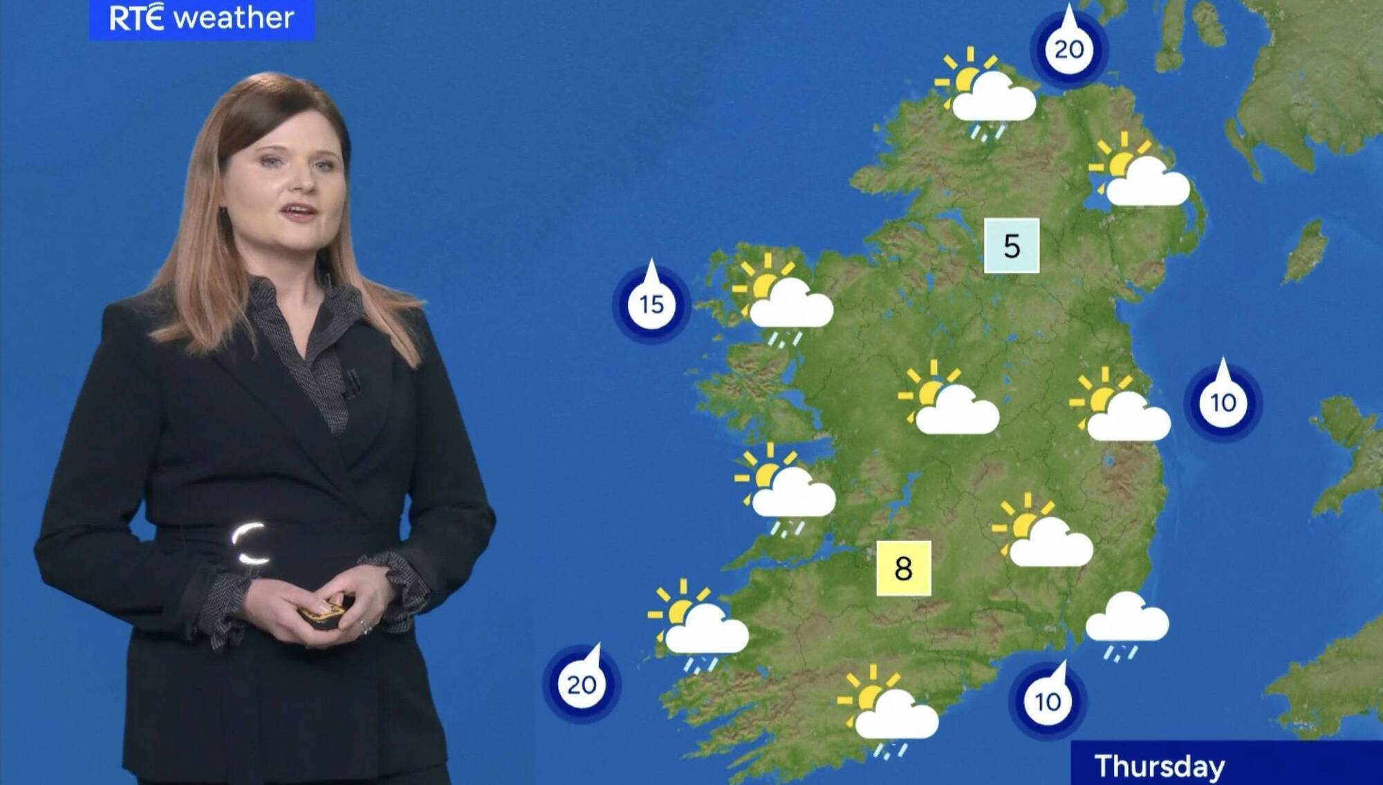
RTÉ says its new weather graphic system 'is designed to ensure that viewers across Ireland, not just those in major population centres, can see their own area reflected in our forecasts...'

Readers of my vintage — and riper — will recall with affection an RTÉ programme of the dim and distant past: , presented by Arthur Murphy.
Viewers wrote in with their observations and complaints about the week’s programmes, and the bould Arthur would read them out and offer his opinion, or he’d get someone involved in the programme mentioned to appear and explain themselves.
(We didn’t have the internet back then. What can I tell you?) One evening, Arthur read out a letter of complaint, and while there might be little enough in that description to differentiate that contribution from a thousand others, I have never forgotten the very specific criticism outlined.
This writer pointed out that when the weather forecast came on after the news, it often predicted rain, and the on-screen graphic featured little clouds with raindrops falling from them. He observed these raindrops were shown falling right to left on screen — roughly east-to-west — while often the prevailing wind was going from west to east — or from the west to the east — which meant the raindrops were falling against the breeze, thus contradicting the laws of nature, physics, gravity, etc. etc.
(Again, no internet.) All of this came to mind recently when I, too, was scanning RTÉ’s weather forecast and was a little surprised to see places such as Tang featured on the map of Ireland. I was really taken aback, however, to see the forecast has become granular enough to give us the suburbs of Cork. Frankfield. Knocknaheeny. Douglas. Tivoli.
On the one hand, I had the sobering experience of realising I have now become the kind of person who becomes exercised by the details of the nightly weather forecast.
(Have now become . . ? — entire family).
On the other hand, I think it fair enough to ask: what is going on?
Is this a modern equivalent of the coded messages sent to the French Resistance on the eve of D-Day, when the maquisards knew invasion was at hand when they heard ‘Chanson d’automne'? If so, I confess I didn’t get the memo: if we are truly separating ourselves from the rest of the country, I’ll be needing a lot more detail, if someone would just include me in the WhatsApp group.
Or is there some even more subtle message being conveyed by the sequence of Cork suburbs being used? Why Mahon and then Douglas? Why Knocknaheeny and then Frankfield? Is this some kind of sublime trolling from Dublin, an attempt to sow discord in the southern capital?
I got in touch with RTÉ and got a statement of the facts:
“To reflect the widest possible range of communities, the locations featured in the fly-around will change and rotate regularly. This allows us to highlight different parts of the country over time, ensuring a fair spread of coverage. Using the example of Cork, this may change to Douglas, or Mahon for example, just so long as we are representing the local area of each population centre within the fly-around.
"Our aim with these updates is to balance broad national coverage with more localised detail, strengthening RTÉ’s connection to communities in every corner of Ireland."
Yes to connection, yes to different parts of the country, yes to localised detail.
But more on the Cork angle, please. I got on the phone.
“Based on consultation with audiences, we decided, with the sweep-down map, to represent places in more detail,” Dave Timpson of the national broadcaster told me.
“The new weather graphic system is more capable of doing that, and once a month we sit down and rotate the town names that we use on the map. As part of that process, I sit down with Met Éireann, usually with Gerry Murphy, and we look specifically at cities now as well, where we feature various suburbs and rotate those for the forecast too.
As ever, technology is the key to various Cork suburbs now appearing — literally — on the map.
“The reason we can do it is that the system we use now is so sophisticated that the weather modelling can be done down to almost 100m, so it’s very focused. The high-resolution of the weather graphic helps with that, too.
"The meteorology has to stack up as well, that’s the most important part of the equation. There’s certainly an element of connection between RTÉ and local communities, obviously, and reflecting people’s interest in their own communities.
“But the weather forecast is also primarily a matter of public safety, warning people about weather events and giving them notice of adverse conditions they may face. It’s not really about entertainment value, as such. This was an opportunity to bolster the connection between communities and RTÉ but that public safety element, and the meteorological authenticity which drives it, is the primary focus.”
Well, science is science, but people’s attachment to their local places is pretty deep.
“True, we weren’t expecting the reaction it got. We preserved the town names that people were expecting, the likes of Athlone and Castlebar, they’re still there on the rainfall maps, but the reaction to other changes in names has been very big.
“But another issue pops up, for instance, because we would maintain the traditional towns for precipitation map — Athlone is used because it’s seen as being in the centre of the country, for instance, but there’s a misconception that by doing so we’re somehow representing Athlone as the county town of Westmeath by putting it on the forecast map.
“We consistently have people expressing their dissatisfaction that we’re not showcasing Mullingar instead, for instance, but it’s purely about meteorology. Nothing else. The upside, though, is that those are the kinds of communications which helped us decide to do more rotating of the place names in the first place.” Of course, this led me to the most obvious question, which I should have led with.
Where is Dave himself from?
“I’m from Montenotte originally.” Oh. So we’ll be seeing Montenotte on the weather forecast from now on, no doubt.
“I only put it on once, I think,” he laughs. “I usually put on Tivoli or Mayfield instead.”
Fair enough. The savage loves his native shore. Glad to clear up any misunderstanding about the reason our suburbs appear, and the reasons those particular suburbs appear, and the sequence in which they appear.
But keep an ear out for 'Chanson d’automne' all the same.
- X: /mikemoynihanex
- Instagram: /mikemoynihanex
- TikTok: /mikemoynihanex
CONNECT WITH US TODAY



Be the first to know the latest news and updates