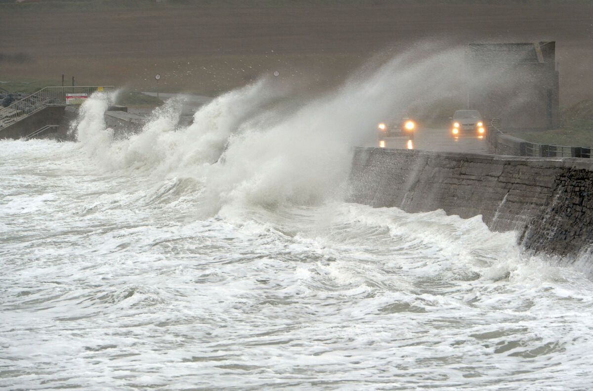
Red warning issued as Cork to get 'biggest hit' from Storm Ellen

A status red wind warning has been issued for Cork as Storm Ellen is expected to hit Ireland this evening.
The warning will be in effect between 9pm and midnight, when Met Éireann says "Storm Ellen will produce a core of very severe and destructive winds." The earlier orange warning will continue in the county overnight from midnight.
A status red weather warning is issued when rare and very dangerous weather conditions are expected to occur.
Status red warning for Cork.
— Met Éireann (@MetEireann) August 19, 2020
See warning here : https://t.co/ozrQHtoOkt pic.twitter.com/4CkYrk3aFO
Gerry Murphy from Met Éireann said Cork will experience extreme winds this evening.
"It's going to get very bad, potentially in Cork in the sense that this depression is moving up and it's spinning quite rapidly. It's going to generate very strong winds," he told C103's Cork Today Show.
"The most up-to-date information is that Cork is going to get the biggest hit from it. The winds will be extremely strong, with damaging gusts well over 120km/hr in places. There will be rain as well.
"It's potentially quite a very stormy night, particularly given the fact we're still meteorologically in the summer. The trees are in bloom which means leaves will be more susceptible to falling at this time of year than they would in winter.
Mr Murphy said there is a possibility that the red-level warning could extend to the east of Waterford.
The Road Safety Authority is advising road users in the area affected not to make any non-essential journeys during the storm window
Met Éireann is also warning of dangerous conditions in all parts of the country overnight.
A status orange wind warning for Galway, Mayo and the rest of Munster takes effect at 9pm tonight and lasts until 6am tomorrow.
Some handy numbers for later #StormEllen #Cork
— Eoin English (@EoinBearla) August 19, 2020
🌳Report fallen trees, road damage in the county to (021) 4800048
⚡️Power outage: ESB Networks 1850 372999
🚰Water outage: Irish Water 1850 278278
Gusts generally of up to 100km/h can be expected and potentially gusts may exceed 130km/h in some exposed coastal and mountain locations and some lower locations due to funnelling effects.
An earlier status orange marine warning has also been upgraded to red.
Met Éireann said there will be gale to storm-force winds, southeast veering southwest, this evening and tonight on all Irish coastal waters and on the Irish Sea.
Winds will reach violent storm-force 11 for a time on coasts from Carnsore point to Valentia to Slyne Head.
There is a status yellow alert for the rest of the country, which will be in place until midnight on Thursday.
Met Éireann has named #StormEllen for potentially damaging & disruptive winds Wed evening & throughout Thur. Risk also of some coastal & inland flooding. Status Orange/Yellow wind warnings are in effect for Ireland & will be updated Wednesday morning. https://t.co/ozrQHtoOkt pic.twitter.com/HHJ4EWqU2l
— Met Éireann (@MetEireann) August 18, 2020
Met Éireann's Head of Forecasting, Evelyn Cusack, says very poor conditions are on the way and tourists in exposed locations will be at risk for these unseasonable stormy and wet conditions.
"Storm Ellen is going to hit Kerry, the south-west of Ireland later this evening and then zip up the west or perhaps in over Ireland tonight," she said.
"There are likely to be quite damaging winds so we are obviously worried about the huge amounts of tourists especially in the south and in the west. Very dangerous conditions indeed."
Ms Cusack added that while the worst of the winds should have passed over the country on Wednesday night, there would still be gales and high seas on Thursday and Friday.
“While the storm itself may pass tonight, you're in for a very, very poor unseasonable weather and a very challenging few days.”
The nationwide yellow alert could escalate to orange alerts because of the uncertainty associated with the storm, she said.
Ms Cusack also warned of flooding, both in coastal areas, and also from rivers and in inland areas. There could be high waves on lakes, she said and she advised that people should not be out hill-walking.
Coastal flooding is a risk across the country with a storm surge and onshore winds that come on top of a high spring tide.

Heavy rain in the counties under the status orange warning could lead to further flood risk.
Storm Ellen is forming over the Atlantic fuelled by the remnants of Hurricane Kyle.
In Cork, where a status red wind warning is in place from 9pm tonight, the city council said the threat of widespread tidal flooding in the city centre tonight and tomorrow morning has receded.
There will however still be low-level pooling along the low-lying city quays from around 7pm tonight and from around 7am tomorrow.
The public has been advised to take care in these areas which include South Terrace, Morrison’s Quay, Fr. Matthew Quay, Trinity Bridge, Union Quay, Sharman Crawford Street, Wandesford Quay, Frenche’s Quay, Crosses Green, Lavitt’s Quay, Kyrl’s Quay.
The council said the likelihood of more widespread tidal flooding from 7pm tomorrow night, coinciding with high tide, still remains and further updates will issue.
UCC's main campus will close from 6pm this evening until 8am tomorrow, as will UCC's Mardyke Sports Grounds and its Curraheen Sports Grounds.
Meanwhile, Fota Wildlife Park will close tomorrow on public safety grounds.
“We are in the process of contacting directly all bookings for this date,” a spokesperson said.
“If you booked to visit the park for this date please stand by for a direct contact update on your booking.
“We apologise for the inconvenience caused. This decision is for the safety of our visitors, staff and animals. We thank you for your patience and understanding.”


